How to Travel from
East Maitland to Coffs Harbour
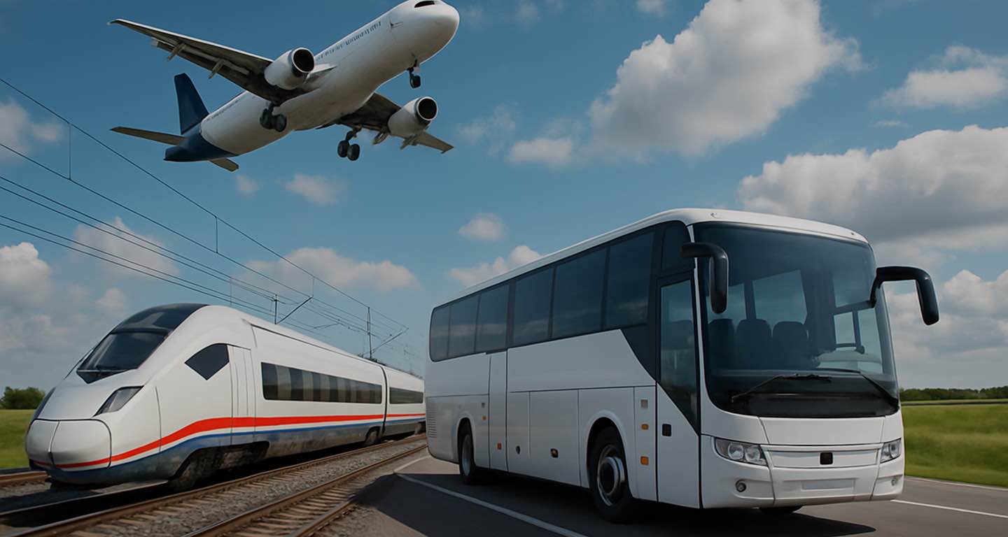
by Train, Bus, Rideshare, Route or Car
Transport search
Transport search
To the map
To the review
[{"selectedTransportType":"car","routePoints":[{"latitude":-32.75086,"longitude":151.5938,"title":"East Maitland"},{"latitude":-30.2962407,"longitude":153.1135293,"title":"Coffs Harbour"}],"compositeRoutePoints":{"2f8931033e5877ce3741cb3fa6dbe4b7":[{"transportType":"train","startPoint":{"title":"Hexham station","latitude":-32.828968,"longitude":151.68422},"endPoint":{"title":"Sydney airport","latitude":-32.829866100000004,"longitude":151.68429346666667},"routeStartPart":true},{"transportType":"plane","startPoint":{"title":"Sydney airport","latitude":-32.829866100000004,"longitude":151.68429346666667},"endPoint":{"title":"Hexham","latitude":-32.8316623,"longitude":151.6844404},"routeEndPart":true}]},"transportTypes":{"car":{"title":"Car","color":"var(--color-transport-car)","icon":"\u003Ci class=\u0022icon iconmoon iconmoon-transport_car\u0022 style=\u0022color:var(--color-white)\u0022 aria-label=\u0027TRANSPORT_CAR\u0027\u003E\u003C\/i\u003E"},"taxi":{"title":"Taxi","color":"var(--color-transport-taxi)","icon":"\u003Ci class=\u0022icon iconmoon iconmoon-transport_taxi\u0022 style=\u0022color:var(--color-white)\u0022 aria-label=\u0027TRANSPORT_TAXI\u0027\u003E\u003C\/i\u003E"},"bus":{"title":"Bus","color":"var(--color-transport-bus)","icon":"\u003Ci class=\u0022icon iconmoon iconmoon-transport_bus\u0022 style=\u0022color:var(--color-white)\u0022 aria-label=\u0027TRANSPORT_BUS\u0027\u003E\u003C\/i\u003E"},"train":{"title":"Train","color":"var(--color-transport-train)","icon":"\u003Ci class=\u0022icon iconmoon iconmoon-transport_train\u0022 style=\u0022color:var(--color-white)\u0022 aria-label=\u0027TRANSPORT_TRAIN\u0027\u003E\u003C\/i\u003E"},"truck":{"title":"Truck","color":"var(--color-transport-truck)","icon":"\u003Ci class=\u0022icon iconmoon iconmoon-transport_truck\u0022 style=\u0022color:var(--color-white)\u0022 aria-label=\u0027TRANSPORT_TRUCK\u0027\u003E\u003C\/i\u003E"},"plane":{"title":"Plane","color":"var(--color-transport-plane)","icon":"\u003Ci class=\u0022icon iconmoon iconmoon-transport_plane\u0022 style=\u0022color:var(--color-white)\u0022 aria-label=\u0027TRANSPORT_PLANE\u0027\u003E\u003C\/i\u003E"},"ride_share":{"title":"Rideshare","color":"var(--color-transport-ride_share)","icon":"\u003Ci class=\u0022icon iconmoon iconmoon-transport_rideshare\u0022 style=\u0022color:var(--color-white)\u0022 aria-label=\u0027TRANSPORT_RIDE_SHARE\u0027\u003E\u003C\/i\u003E"},"people":{"title":"Person","color":"var(--color-transport-people)","icon":"\u003Ci class=\u0022icon iconmoon iconmoon-transport_people\u0022 style=\u0022color:var(--color-white)\u0022 aria-label=\u0027TRANSPORT_PEOPLE\u0027\u003E\u003C\/i\u003E"},"walk":{"title":"Walking","color":"var(--color-transport-walk)","icon":"\u003Ci class=\u0022icon iconmoon iconmoon-transport_walk\u0022 style=\u0022color:var(--color-white)\u0022 aria-label=\u0027TRANSPORT_WALK\u0027\u003E\u003C\/i\u003E"},"bike":{"title":"Bicycle","color":"var(--color-transport-bike)","icon":"\u003Ci class=\u0022icon iconmoon iconmoon-transport_bike\u0022 style=\u0022color:var(--color-white)\u0022 aria-label=\u0027TRANSPORT_BIKE\u0027\u003E\u003C\/i\u003E"},"transfer":{"title":"Transfer","color":"var(--color-transport-transfer)","icon":"\u003Ci class=\u0022icon iconmoon iconmoon-transport_transfer\u0022 style=\u0022color:var(--color-white)\u0022 aria-label=\u0027TRANSPORT_TRANSFER\u0027\u003E\u003C\/i\u003E"},"subway":{"title":"Subway","color":"var(--color-transport-subway)","icon":"\u003Ci class=\u0022icon iconmoon iconmoon-transport_subway\u0022 style=\u0022color:var(--color-white)\u0022 aria-label=\u0027TRANSPORT_SUBWAY\u0027\u003E\u003C\/i\u003E"},"composite":{"title":"Route","color":"var(--color-transport-composite)","icon":"\u003Ci class=\u0022icon iconmoon iconmoon-transport_transfer\u0022 style=\u0022color:var(--color-white)\u0022 aria-label=\u0027TRANSPORT_TRANSFER\u0027\u003E\u003C\/i\u003E"},"carsharing":{"title":"Carsharing","color":"var(--color-transport-carsharing)","icon":"\u003Ci class=\u0022icon iconmoon iconmoon-transport_carsharing\u0022 style=\u0022color:var(--color-white)\u0022 aria-label=\u0027TRANSPORT_CARSHARING\u0027\u003E\u003C\/i\u003E"},"suburban":{"title":"Electric Train","color":"var(--color-transport-suburban)","icon":"\u003Ci class=\u0022icon iconmoon iconmoon-transport_suburban\u0022 style=\u0022color:var(--color-white)\u0022 aria-label=\u0027TRANSPORT_SUBURBAN\u0027\u003E\u003C\/i\u003E"},"tram":{"title":"Tram","color":"var(--color-transport-tram)","icon":"\u003Ci class=\u0022icon iconmoon iconmoon-transport_tram\u0022 style=\u0022color:var(--color-white)\u0022 aria-label=\u0027TRANSPORT_TRAM\u0027\u003E\u003C\/i\u003E"},"trolleybus":{"title":"Trolleybus","color":"var(--color-transport-trolleybus)","icon":"\u003Ci class=\u0022icon iconmoon iconmoon-transport_trolleybus\u0022 style=\u0022color:var(--color-white)\u0022 aria-label=\u0027TRANSPORT_TROLLEYBUS\u0027\u003E\u003C\/i\u003E"},"cable_car":{"title":"Funicular","color":"var(--color-transport-cable_car)","icon":"\u003Ci class=\u0022icon iconmoon iconmoon-transport_funicular\u0022 style=\u0022color:var(--color-white)\u0022 aria-label=\u0027TRANSPORT_CABLE_CAR\u0027\u003E\u003C\/i\u003E"},"rail":{"title":"Rail","color":"var(--color-transport-rail)","icon":"\u003Ci class=\u0022icon iconmoon iconmoon-transport_train\u0022 style=\u0022color:var(--color-white)\u0022 aria-label=\u0027TRANSPORT_TRAIN\u0027\u003E\u003C\/i\u003E"},"ferry":{"title":"Ferry","color":"var(--color-transport-ferry)","icon":"\u003Ci class=\u0022icon iconmoon iconmoon-transport_ferry\u0022 style=\u0022color:var(--color-white)\u0022 aria-label=\u0027TRANSPORT_FERRY\u0027\u003E\u003C\/i\u003E"},"rent":{"title":"Rent auto","color":"var(--color-transport-rent)","icon":"\u003Ci class=\u0022icon iconmoon iconmoon-transport_rent\u0022 style=\u0022color:var(--color-white)\u0022 aria-label=\u0027TRANSPORT_RENT\u0027\u003E\u003C\/i\u003E"},"unknown":{"title":"Unknown","color":"var(--color-transport-unknown)","icon":"\u003Ci class=\u0022icon iconmoon iconmoon-transport_transfer\u0022 style=\u0022color:var(--color-white)\u0022 aria-label=\u0027TRANSPORT_TRANSFER\u0027\u003E\u003C\/i\u003E"}},"pointIcon":"\u003Ci class=\u0022icon iconmoon iconmoon-map_point\u0022 style=\u0022color:var(--color-primary)\u0022 aria-label=\u0027MAP_POINT\u0027\u003E\u003C\/i\u003E","routeId":44927172}, {"selectedTransportType":"train","routePoints":[{"latitude":-32.75086,"longitude":151.5938,"title":"East Maitland"},{"latitude":-30.2962407,"longitude":153.1135293,"title":"Coffs Harbour"}],"compositeRoutePoints":{"2f8931033e5877ce3741cb3fa6dbe4b7":[{"transportType":"train","startPoint":{"title":"Hexham station","latitude":-32.828968,"longitude":151.68422},"endPoint":{"title":"Sydney airport","latitude":-32.829866100000004,"longitude":151.68429346666667},"routeStartPart":true},{"transportType":"plane","startPoint":{"title":"Sydney airport","latitude":-32.829866100000004,"longitude":151.68429346666667},"endPoint":{"title":"Hexham","latitude":-32.8316623,"longitude":151.6844404},"routeEndPart":true}]},"transportTypes":{"car":{"title":"Car","color":"var(--color-transport-car)","icon":"\u003Ci class=\u0022icon iconmoon iconmoon-transport_car\u0022 style=\u0022color:var(--color-white)\u0022 aria-label=\u0027TRANSPORT_CAR\u0027\u003E\u003C\/i\u003E"},"taxi":{"title":"Taxi","color":"var(--color-transport-taxi)","icon":"\u003Ci class=\u0022icon iconmoon iconmoon-transport_taxi\u0022 style=\u0022color:var(--color-white)\u0022 aria-label=\u0027TRANSPORT_TAXI\u0027\u003E\u003C\/i\u003E"},"bus":{"title":"Bus","color":"var(--color-transport-bus)","icon":"\u003Ci class=\u0022icon iconmoon iconmoon-transport_bus\u0022 style=\u0022color:var(--color-white)\u0022 aria-label=\u0027TRANSPORT_BUS\u0027\u003E\u003C\/i\u003E"},"train":{"title":"Train","color":"var(--color-transport-train)","icon":"\u003Ci class=\u0022icon iconmoon iconmoon-transport_train\u0022 style=\u0022color:var(--color-white)\u0022 aria-label=\u0027TRANSPORT_TRAIN\u0027\u003E\u003C\/i\u003E"},"truck":{"title":"Truck","color":"var(--color-transport-truck)","icon":"\u003Ci class=\u0022icon iconmoon iconmoon-transport_truck\u0022 style=\u0022color:var(--color-white)\u0022 aria-label=\u0027TRANSPORT_TRUCK\u0027\u003E\u003C\/i\u003E"},"plane":{"title":"Plane","color":"var(--color-transport-plane)","icon":"\u003Ci class=\u0022icon iconmoon iconmoon-transport_plane\u0022 style=\u0022color:var(--color-white)\u0022 aria-label=\u0027TRANSPORT_PLANE\u0027\u003E\u003C\/i\u003E"},"ride_share":{"title":"Rideshare","color":"var(--color-transport-ride_share)","icon":"\u003Ci class=\u0022icon iconmoon iconmoon-transport_rideshare\u0022 style=\u0022color:var(--color-white)\u0022 aria-label=\u0027TRANSPORT_RIDE_SHARE\u0027\u003E\u003C\/i\u003E"},"people":{"title":"Person","color":"var(--color-transport-people)","icon":"\u003Ci class=\u0022icon iconmoon iconmoon-transport_people\u0022 style=\u0022color:var(--color-white)\u0022 aria-label=\u0027TRANSPORT_PEOPLE\u0027\u003E\u003C\/i\u003E"},"walk":{"title":"Walking","color":"var(--color-transport-walk)","icon":"\u003Ci class=\u0022icon iconmoon iconmoon-transport_walk\u0022 style=\u0022color:var(--color-white)\u0022 aria-label=\u0027TRANSPORT_WALK\u0027\u003E\u003C\/i\u003E"},"bike":{"title":"Bicycle","color":"var(--color-transport-bike)","icon":"\u003Ci class=\u0022icon iconmoon iconmoon-transport_bike\u0022 style=\u0022color:var(--color-white)\u0022 aria-label=\u0027TRANSPORT_BIKE\u0027\u003E\u003C\/i\u003E"},"transfer":{"title":"Transfer","color":"var(--color-transport-transfer)","icon":"\u003Ci class=\u0022icon iconmoon iconmoon-transport_transfer\u0022 style=\u0022color:var(--color-white)\u0022 aria-label=\u0027TRANSPORT_TRANSFER\u0027\u003E\u003C\/i\u003E"},"subway":{"title":"Subway","color":"var(--color-transport-subway)","icon":"\u003Ci class=\u0022icon iconmoon iconmoon-transport_subway\u0022 style=\u0022color:var(--color-white)\u0022 aria-label=\u0027TRANSPORT_SUBWAY\u0027\u003E\u003C\/i\u003E"},"composite":{"title":"Route","color":"var(--color-transport-composite)","icon":"\u003Ci class=\u0022icon iconmoon iconmoon-transport_transfer\u0022 style=\u0022color:var(--color-white)\u0022 aria-label=\u0027TRANSPORT_TRANSFER\u0027\u003E\u003C\/i\u003E"},"carsharing":{"title":"Carsharing","color":"var(--color-transport-carsharing)","icon":"\u003Ci class=\u0022icon iconmoon iconmoon-transport_carsharing\u0022 style=\u0022color:var(--color-white)\u0022 aria-label=\u0027TRANSPORT_CARSHARING\u0027\u003E\u003C\/i\u003E"},"suburban":{"title":"Electric Train","color":"var(--color-transport-suburban)","icon":"\u003Ci class=\u0022icon iconmoon iconmoon-transport_suburban\u0022 style=\u0022color:var(--color-white)\u0022 aria-label=\u0027TRANSPORT_SUBURBAN\u0027\u003E\u003C\/i\u003E"},"tram":{"title":"Tram","color":"var(--color-transport-tram)","icon":"\u003Ci class=\u0022icon iconmoon iconmoon-transport_tram\u0022 style=\u0022color:var(--color-white)\u0022 aria-label=\u0027TRANSPORT_TRAM\u0027\u003E\u003C\/i\u003E"},"trolleybus":{"title":"Trolleybus","color":"var(--color-transport-trolleybus)","icon":"\u003Ci class=\u0022icon iconmoon iconmoon-transport_trolleybus\u0022 style=\u0022color:var(--color-white)\u0022 aria-label=\u0027TRANSPORT_TROLLEYBUS\u0027\u003E\u003C\/i\u003E"},"cable_car":{"title":"Funicular","color":"var(--color-transport-cable_car)","icon":"\u003Ci class=\u0022icon iconmoon iconmoon-transport_funicular\u0022 style=\u0022color:var(--color-white)\u0022 aria-label=\u0027TRANSPORT_CABLE_CAR\u0027\u003E\u003C\/i\u003E"},"rail":{"title":"Rail","color":"var(--color-transport-rail)","icon":"\u003Ci class=\u0022icon iconmoon iconmoon-transport_train\u0022 style=\u0022color:var(--color-white)\u0022 aria-label=\u0027TRANSPORT_TRAIN\u0027\u003E\u003C\/i\u003E"},"ferry":{"title":"Ferry","color":"var(--color-transport-ferry)","icon":"\u003Ci class=\u0022icon iconmoon iconmoon-transport_ferry\u0022 style=\u0022color:var(--color-white)\u0022 aria-label=\u0027TRANSPORT_FERRY\u0027\u003E\u003C\/i\u003E"},"rent":{"title":"Rent auto","color":"var(--color-transport-rent)","icon":"\u003Ci class=\u0022icon iconmoon iconmoon-transport_rent\u0022 style=\u0022color:var(--color-white)\u0022 aria-label=\u0027TRANSPORT_RENT\u0027\u003E\u003C\/i\u003E"},"unknown":{"title":"Unknown","color":"var(--color-transport-unknown)","icon":"\u003Ci class=\u0022icon iconmoon iconmoon-transport_transfer\u0022 style=\u0022color:var(--color-white)\u0022 aria-label=\u0027TRANSPORT_TRANSFER\u0027\u003E\u003C\/i\u003E"}},"pointIcon":"\u003Ci class=\u0022icon iconmoon iconmoon-map_point\u0022 style=\u0022color:var(--color-primary)\u0022 aria-label=\u0027MAP_POINT\u0027\u003E\u003C\/i\u003E","routeId":44927172}, {"selectedTransportType":"bus","routePoints":[{"latitude":-32.75086,"longitude":151.5938,"title":"East Maitland"},{"latitude":-30.2962407,"longitude":153.1135293,"title":"Coffs Harbour"}],"compositeRoutePoints":{"2f8931033e5877ce3741cb3fa6dbe4b7":[{"transportType":"train","startPoint":{"title":"Hexham station","latitude":-32.828968,"longitude":151.68422},"endPoint":{"title":"Sydney airport","latitude":-32.829866100000004,"longitude":151.68429346666667},"routeStartPart":true},{"transportType":"plane","startPoint":{"title":"Sydney airport","latitude":-32.829866100000004,"longitude":151.68429346666667},"endPoint":{"title":"Hexham","latitude":-32.8316623,"longitude":151.6844404},"routeEndPart":true}]},"transportTypes":{"car":{"title":"Car","color":"var(--color-transport-car)","icon":"\u003Ci class=\u0022icon iconmoon iconmoon-transport_car\u0022 style=\u0022color:var(--color-white)\u0022 aria-label=\u0027TRANSPORT_CAR\u0027\u003E\u003C\/i\u003E"},"taxi":{"title":"Taxi","color":"var(--color-transport-taxi)","icon":"\u003Ci class=\u0022icon iconmoon iconmoon-transport_taxi\u0022 style=\u0022color:var(--color-white)\u0022 aria-label=\u0027TRANSPORT_TAXI\u0027\u003E\u003C\/i\u003E"},"bus":{"title":"Bus","color":"var(--color-transport-bus)","icon":"\u003Ci class=\u0022icon iconmoon iconmoon-transport_bus\u0022 style=\u0022color:var(--color-white)\u0022 aria-label=\u0027TRANSPORT_BUS\u0027\u003E\u003C\/i\u003E"},"train":{"title":"Train","color":"var(--color-transport-train)","icon":"\u003Ci class=\u0022icon iconmoon iconmoon-transport_train\u0022 style=\u0022color:var(--color-white)\u0022 aria-label=\u0027TRANSPORT_TRAIN\u0027\u003E\u003C\/i\u003E"},"truck":{"title":"Truck","color":"var(--color-transport-truck)","icon":"\u003Ci class=\u0022icon iconmoon iconmoon-transport_truck\u0022 style=\u0022color:var(--color-white)\u0022 aria-label=\u0027TRANSPORT_TRUCK\u0027\u003E\u003C\/i\u003E"},"plane":{"title":"Plane","color":"var(--color-transport-plane)","icon":"\u003Ci class=\u0022icon iconmoon iconmoon-transport_plane\u0022 style=\u0022color:var(--color-white)\u0022 aria-label=\u0027TRANSPORT_PLANE\u0027\u003E\u003C\/i\u003E"},"ride_share":{"title":"Rideshare","color":"var(--color-transport-ride_share)","icon":"\u003Ci class=\u0022icon iconmoon iconmoon-transport_rideshare\u0022 style=\u0022color:var(--color-white)\u0022 aria-label=\u0027TRANSPORT_RIDE_SHARE\u0027\u003E\u003C\/i\u003E"},"people":{"title":"Person","color":"var(--color-transport-people)","icon":"\u003Ci class=\u0022icon iconmoon iconmoon-transport_people\u0022 style=\u0022color:var(--color-white)\u0022 aria-label=\u0027TRANSPORT_PEOPLE\u0027\u003E\u003C\/i\u003E"},"walk":{"title":"Walking","color":"var(--color-transport-walk)","icon":"\u003Ci class=\u0022icon iconmoon iconmoon-transport_walk\u0022 style=\u0022color:var(--color-white)\u0022 aria-label=\u0027TRANSPORT_WALK\u0027\u003E\u003C\/i\u003E"},"bike":{"title":"Bicycle","color":"var(--color-transport-bike)","icon":"\u003Ci class=\u0022icon iconmoon iconmoon-transport_bike\u0022 style=\u0022color:var(--color-white)\u0022 aria-label=\u0027TRANSPORT_BIKE\u0027\u003E\u003C\/i\u003E"},"transfer":{"title":"Transfer","color":"var(--color-transport-transfer)","icon":"\u003Ci class=\u0022icon iconmoon iconmoon-transport_transfer\u0022 style=\u0022color:var(--color-white)\u0022 aria-label=\u0027TRANSPORT_TRANSFER\u0027\u003E\u003C\/i\u003E"},"subway":{"title":"Subway","color":"var(--color-transport-subway)","icon":"\u003Ci class=\u0022icon iconmoon iconmoon-transport_subway\u0022 style=\u0022color:var(--color-white)\u0022 aria-label=\u0027TRANSPORT_SUBWAY\u0027\u003E\u003C\/i\u003E"},"composite":{"title":"Route","color":"var(--color-transport-composite)","icon":"\u003Ci class=\u0022icon iconmoon iconmoon-transport_transfer\u0022 style=\u0022color:var(--color-white)\u0022 aria-label=\u0027TRANSPORT_TRANSFER\u0027\u003E\u003C\/i\u003E"},"carsharing":{"title":"Carsharing","color":"var(--color-transport-carsharing)","icon":"\u003Ci class=\u0022icon iconmoon iconmoon-transport_carsharing\u0022 style=\u0022color:var(--color-white)\u0022 aria-label=\u0027TRANSPORT_CARSHARING\u0027\u003E\u003C\/i\u003E"},"suburban":{"title":"Electric Train","color":"var(--color-transport-suburban)","icon":"\u003Ci class=\u0022icon iconmoon iconmoon-transport_suburban\u0022 style=\u0022color:var(--color-white)\u0022 aria-label=\u0027TRANSPORT_SUBURBAN\u0027\u003E\u003C\/i\u003E"},"tram":{"title":"Tram","color":"var(--color-transport-tram)","icon":"\u003Ci class=\u0022icon iconmoon iconmoon-transport_tram\u0022 style=\u0022color:var(--color-white)\u0022 aria-label=\u0027TRANSPORT_TRAM\u0027\u003E\u003C\/i\u003E"},"trolleybus":{"title":"Trolleybus","color":"var(--color-transport-trolleybus)","icon":"\u003Ci class=\u0022icon iconmoon iconmoon-transport_trolleybus\u0022 style=\u0022color:var(--color-white)\u0022 aria-label=\u0027TRANSPORT_TROLLEYBUS\u0027\u003E\u003C\/i\u003E"},"cable_car":{"title":"Funicular","color":"var(--color-transport-cable_car)","icon":"\u003Ci class=\u0022icon iconmoon iconmoon-transport_funicular\u0022 style=\u0022color:var(--color-white)\u0022 aria-label=\u0027TRANSPORT_CABLE_CAR\u0027\u003E\u003C\/i\u003E"},"rail":{"title":"Rail","color":"var(--color-transport-rail)","icon":"\u003Ci class=\u0022icon iconmoon iconmoon-transport_train\u0022 style=\u0022color:var(--color-white)\u0022 aria-label=\u0027TRANSPORT_TRAIN\u0027\u003E\u003C\/i\u003E"},"ferry":{"title":"Ferry","color":"var(--color-transport-ferry)","icon":"\u003Ci class=\u0022icon iconmoon iconmoon-transport_ferry\u0022 style=\u0022color:var(--color-white)\u0022 aria-label=\u0027TRANSPORT_FERRY\u0027\u003E\u003C\/i\u003E"},"rent":{"title":"Rent auto","color":"var(--color-transport-rent)","icon":"\u003Ci class=\u0022icon iconmoon iconmoon-transport_rent\u0022 style=\u0022color:var(--color-white)\u0022 aria-label=\u0027TRANSPORT_RENT\u0027\u003E\u003C\/i\u003E"},"unknown":{"title":"Unknown","color":"var(--color-transport-unknown)","icon":"\u003Ci class=\u0022icon iconmoon iconmoon-transport_transfer\u0022 style=\u0022color:var(--color-white)\u0022 aria-label=\u0027TRANSPORT_TRANSFER\u0027\u003E\u003C\/i\u003E"}},"pointIcon":"\u003Ci class=\u0022icon iconmoon iconmoon-map_point\u0022 style=\u0022color:var(--color-primary)\u0022 aria-label=\u0027MAP_POINT\u0027\u003E\u003C\/i\u003E","routeId":44927172}, {"selectedTransportType":"ride_share","routePoints":[{"latitude":-32.75086,"longitude":151.5938,"title":"East Maitland"},{"latitude":-30.2962407,"longitude":153.1135293,"title":"Coffs Harbour"}],"compositeRoutePoints":{"2f8931033e5877ce3741cb3fa6dbe4b7":[{"transportType":"train","startPoint":{"title":"Hexham station","latitude":-32.828968,"longitude":151.68422},"endPoint":{"title":"Sydney airport","latitude":-32.829866100000004,"longitude":151.68429346666667},"routeStartPart":true},{"transportType":"plane","startPoint":{"title":"Sydney airport","latitude":-32.829866100000004,"longitude":151.68429346666667},"endPoint":{"title":"Hexham","latitude":-32.8316623,"longitude":151.6844404},"routeEndPart":true}]},"transportTypes":{"car":{"title":"Car","color":"var(--color-transport-car)","icon":"\u003Ci class=\u0022icon iconmoon iconmoon-transport_car\u0022 style=\u0022color:var(--color-white)\u0022 aria-label=\u0027TRANSPORT_CAR\u0027\u003E\u003C\/i\u003E"},"taxi":{"title":"Taxi","color":"var(--color-transport-taxi)","icon":"\u003Ci class=\u0022icon iconmoon iconmoon-transport_taxi\u0022 style=\u0022color:var(--color-white)\u0022 aria-label=\u0027TRANSPORT_TAXI\u0027\u003E\u003C\/i\u003E"},"bus":{"title":"Bus","color":"var(--color-transport-bus)","icon":"\u003Ci class=\u0022icon iconmoon iconmoon-transport_bus\u0022 style=\u0022color:var(--color-white)\u0022 aria-label=\u0027TRANSPORT_BUS\u0027\u003E\u003C\/i\u003E"},"train":{"title":"Train","color":"var(--color-transport-train)","icon":"\u003Ci class=\u0022icon iconmoon iconmoon-transport_train\u0022 style=\u0022color:var(--color-white)\u0022 aria-label=\u0027TRANSPORT_TRAIN\u0027\u003E\u003C\/i\u003E"},"truck":{"title":"Truck","color":"var(--color-transport-truck)","icon":"\u003Ci class=\u0022icon iconmoon iconmoon-transport_truck\u0022 style=\u0022color:var(--color-white)\u0022 aria-label=\u0027TRANSPORT_TRUCK\u0027\u003E\u003C\/i\u003E"},"plane":{"title":"Plane","color":"var(--color-transport-plane)","icon":"\u003Ci class=\u0022icon iconmoon iconmoon-transport_plane\u0022 style=\u0022color:var(--color-white)\u0022 aria-label=\u0027TRANSPORT_PLANE\u0027\u003E\u003C\/i\u003E"},"ride_share":{"title":"Rideshare","color":"var(--color-transport-ride_share)","icon":"\u003Ci class=\u0022icon iconmoon iconmoon-transport_rideshare\u0022 style=\u0022color:var(--color-white)\u0022 aria-label=\u0027TRANSPORT_RIDE_SHARE\u0027\u003E\u003C\/i\u003E"},"people":{"title":"Person","color":"var(--color-transport-people)","icon":"\u003Ci class=\u0022icon iconmoon iconmoon-transport_people\u0022 style=\u0022color:var(--color-white)\u0022 aria-label=\u0027TRANSPORT_PEOPLE\u0027\u003E\u003C\/i\u003E"},"walk":{"title":"Walking","color":"var(--color-transport-walk)","icon":"\u003Ci class=\u0022icon iconmoon iconmoon-transport_walk\u0022 style=\u0022color:var(--color-white)\u0022 aria-label=\u0027TRANSPORT_WALK\u0027\u003E\u003C\/i\u003E"},"bike":{"title":"Bicycle","color":"var(--color-transport-bike)","icon":"\u003Ci class=\u0022icon iconmoon iconmoon-transport_bike\u0022 style=\u0022color:var(--color-white)\u0022 aria-label=\u0027TRANSPORT_BIKE\u0027\u003E\u003C\/i\u003E"},"transfer":{"title":"Transfer","color":"var(--color-transport-transfer)","icon":"\u003Ci class=\u0022icon iconmoon iconmoon-transport_transfer\u0022 style=\u0022color:var(--color-white)\u0022 aria-label=\u0027TRANSPORT_TRANSFER\u0027\u003E\u003C\/i\u003E"},"subway":{"title":"Subway","color":"var(--color-transport-subway)","icon":"\u003Ci class=\u0022icon iconmoon iconmoon-transport_subway\u0022 style=\u0022color:var(--color-white)\u0022 aria-label=\u0027TRANSPORT_SUBWAY\u0027\u003E\u003C\/i\u003E"},"composite":{"title":"Route","color":"var(--color-transport-composite)","icon":"\u003Ci class=\u0022icon iconmoon iconmoon-transport_transfer\u0022 style=\u0022color:var(--color-white)\u0022 aria-label=\u0027TRANSPORT_TRANSFER\u0027\u003E\u003C\/i\u003E"},"carsharing":{"title":"Carsharing","color":"var(--color-transport-carsharing)","icon":"\u003Ci class=\u0022icon iconmoon iconmoon-transport_carsharing\u0022 style=\u0022color:var(--color-white)\u0022 aria-label=\u0027TRANSPORT_CARSHARING\u0027\u003E\u003C\/i\u003E"},"suburban":{"title":"Electric Train","color":"var(--color-transport-suburban)","icon":"\u003Ci class=\u0022icon iconmoon iconmoon-transport_suburban\u0022 style=\u0022color:var(--color-white)\u0022 aria-label=\u0027TRANSPORT_SUBURBAN\u0027\u003E\u003C\/i\u003E"},"tram":{"title":"Tram","color":"var(--color-transport-tram)","icon":"\u003Ci class=\u0022icon iconmoon iconmoon-transport_tram\u0022 style=\u0022color:var(--color-white)\u0022 aria-label=\u0027TRANSPORT_TRAM\u0027\u003E\u003C\/i\u003E"},"trolleybus":{"title":"Trolleybus","color":"var(--color-transport-trolleybus)","icon":"\u003Ci class=\u0022icon iconmoon iconmoon-transport_trolleybus\u0022 style=\u0022color:var(--color-white)\u0022 aria-label=\u0027TRANSPORT_TROLLEYBUS\u0027\u003E\u003C\/i\u003E"},"cable_car":{"title":"Funicular","color":"var(--color-transport-cable_car)","icon":"\u003Ci class=\u0022icon iconmoon iconmoon-transport_funicular\u0022 style=\u0022color:var(--color-white)\u0022 aria-label=\u0027TRANSPORT_CABLE_CAR\u0027\u003E\u003C\/i\u003E"},"rail":{"title":"Rail","color":"var(--color-transport-rail)","icon":"\u003Ci class=\u0022icon iconmoon iconmoon-transport_train\u0022 style=\u0022color:var(--color-white)\u0022 aria-label=\u0027TRANSPORT_TRAIN\u0027\u003E\u003C\/i\u003E"},"ferry":{"title":"Ferry","color":"var(--color-transport-ferry)","icon":"\u003Ci class=\u0022icon iconmoon iconmoon-transport_ferry\u0022 style=\u0022color:var(--color-white)\u0022 aria-label=\u0027TRANSPORT_FERRY\u0027\u003E\u003C\/i\u003E"},"rent":{"title":"Rent auto","color":"var(--color-transport-rent)","icon":"\u003Ci class=\u0022icon iconmoon iconmoon-transport_rent\u0022 style=\u0022color:var(--color-white)\u0022 aria-label=\u0027TRANSPORT_RENT\u0027\u003E\u003C\/i\u003E"},"unknown":{"title":"Unknown","color":"var(--color-transport-unknown)","icon":"\u003Ci class=\u0022icon iconmoon iconmoon-transport_transfer\u0022 style=\u0022color:var(--color-white)\u0022 aria-label=\u0027TRANSPORT_TRANSFER\u0027\u003E\u003C\/i\u003E"}},"pointIcon":"\u003Ci class=\u0022icon iconmoon iconmoon-map_point\u0022 style=\u0022color:var(--color-primary)\u0022 aria-label=\u0027MAP_POINT\u0027\u003E\u003C\/i\u003E","routeId":44927172}, {"selectedTransportType":"composite","routePoints":[{"latitude":-32.75086,"longitude":151.5938,"title":"East Maitland"},{"latitude":-30.2962407,"longitude":153.1135293,"title":"Coffs Harbour"}],"compositeRoutePoints":{"2f8931033e5877ce3741cb3fa6dbe4b7":[{"transportType":"train","startPoint":{"title":"Hexham station","latitude":-32.828968,"longitude":151.68422},"endPoint":{"title":"Sydney airport","latitude":-32.829866100000004,"longitude":151.68429346666667},"routeStartPart":true},{"transportType":"plane","startPoint":{"title":"Sydney airport","latitude":-32.829866100000004,"longitude":151.68429346666667},"endPoint":{"title":"Hexham","latitude":-32.8316623,"longitude":151.6844404},"routeEndPart":true}]},"transportTypes":{"car":{"title":"Car","color":"var(--color-transport-car)","icon":"\u003Ci class=\u0022icon iconmoon iconmoon-transport_car\u0022 style=\u0022color:var(--color-white)\u0022 aria-label=\u0027TRANSPORT_CAR\u0027\u003E\u003C\/i\u003E"},"taxi":{"title":"Taxi","color":"var(--color-transport-taxi)","icon":"\u003Ci class=\u0022icon iconmoon iconmoon-transport_taxi\u0022 style=\u0022color:var(--color-white)\u0022 aria-label=\u0027TRANSPORT_TAXI\u0027\u003E\u003C\/i\u003E"},"bus":{"title":"Bus","color":"var(--color-transport-bus)","icon":"\u003Ci class=\u0022icon iconmoon iconmoon-transport_bus\u0022 style=\u0022color:var(--color-white)\u0022 aria-label=\u0027TRANSPORT_BUS\u0027\u003E\u003C\/i\u003E"},"train":{"title":"Train","color":"var(--color-transport-train)","icon":"\u003Ci class=\u0022icon iconmoon iconmoon-transport_train\u0022 style=\u0022color:var(--color-white)\u0022 aria-label=\u0027TRANSPORT_TRAIN\u0027\u003E\u003C\/i\u003E"},"truck":{"title":"Truck","color":"var(--color-transport-truck)","icon":"\u003Ci class=\u0022icon iconmoon iconmoon-transport_truck\u0022 style=\u0022color:var(--color-white)\u0022 aria-label=\u0027TRANSPORT_TRUCK\u0027\u003E\u003C\/i\u003E"},"plane":{"title":"Plane","color":"var(--color-transport-plane)","icon":"\u003Ci class=\u0022icon iconmoon iconmoon-transport_plane\u0022 style=\u0022color:var(--color-white)\u0022 aria-label=\u0027TRANSPORT_PLANE\u0027\u003E\u003C\/i\u003E"},"ride_share":{"title":"Rideshare","color":"var(--color-transport-ride_share)","icon":"\u003Ci class=\u0022icon iconmoon iconmoon-transport_rideshare\u0022 style=\u0022color:var(--color-white)\u0022 aria-label=\u0027TRANSPORT_RIDE_SHARE\u0027\u003E\u003C\/i\u003E"},"people":{"title":"Person","color":"var(--color-transport-people)","icon":"\u003Ci class=\u0022icon iconmoon iconmoon-transport_people\u0022 style=\u0022color:var(--color-white)\u0022 aria-label=\u0027TRANSPORT_PEOPLE\u0027\u003E\u003C\/i\u003E"},"walk":{"title":"Walking","color":"var(--color-transport-walk)","icon":"\u003Ci class=\u0022icon iconmoon iconmoon-transport_walk\u0022 style=\u0022color:var(--color-white)\u0022 aria-label=\u0027TRANSPORT_WALK\u0027\u003E\u003C\/i\u003E"},"bike":{"title":"Bicycle","color":"var(--color-transport-bike)","icon":"\u003Ci class=\u0022icon iconmoon iconmoon-transport_bike\u0022 style=\u0022color:var(--color-white)\u0022 aria-label=\u0027TRANSPORT_BIKE\u0027\u003E\u003C\/i\u003E"},"transfer":{"title":"Transfer","color":"var(--color-transport-transfer)","icon":"\u003Ci class=\u0022icon iconmoon iconmoon-transport_transfer\u0022 style=\u0022color:var(--color-white)\u0022 aria-label=\u0027TRANSPORT_TRANSFER\u0027\u003E\u003C\/i\u003E"},"subway":{"title":"Subway","color":"var(--color-transport-subway)","icon":"\u003Ci class=\u0022icon iconmoon iconmoon-transport_subway\u0022 style=\u0022color:var(--color-white)\u0022 aria-label=\u0027TRANSPORT_SUBWAY\u0027\u003E\u003C\/i\u003E"},"composite":{"title":"Route","color":"var(--color-transport-composite)","icon":"\u003Ci class=\u0022icon iconmoon iconmoon-transport_transfer\u0022 style=\u0022color:var(--color-white)\u0022 aria-label=\u0027TRANSPORT_TRANSFER\u0027\u003E\u003C\/i\u003E"},"carsharing":{"title":"Carsharing","color":"var(--color-transport-carsharing)","icon":"\u003Ci class=\u0022icon iconmoon iconmoon-transport_carsharing\u0022 style=\u0022color:var(--color-white)\u0022 aria-label=\u0027TRANSPORT_CARSHARING\u0027\u003E\u003C\/i\u003E"},"suburban":{"title":"Electric Train","color":"var(--color-transport-suburban)","icon":"\u003Ci class=\u0022icon iconmoon iconmoon-transport_suburban\u0022 style=\u0022color:var(--color-white)\u0022 aria-label=\u0027TRANSPORT_SUBURBAN\u0027\u003E\u003C\/i\u003E"},"tram":{"title":"Tram","color":"var(--color-transport-tram)","icon":"\u003Ci class=\u0022icon iconmoon iconmoon-transport_tram\u0022 style=\u0022color:var(--color-white)\u0022 aria-label=\u0027TRANSPORT_TRAM\u0027\u003E\u003C\/i\u003E"},"trolleybus":{"title":"Trolleybus","color":"var(--color-transport-trolleybus)","icon":"\u003Ci class=\u0022icon iconmoon iconmoon-transport_trolleybus\u0022 style=\u0022color:var(--color-white)\u0022 aria-label=\u0027TRANSPORT_TROLLEYBUS\u0027\u003E\u003C\/i\u003E"},"cable_car":{"title":"Funicular","color":"var(--color-transport-cable_car)","icon":"\u003Ci class=\u0022icon iconmoon iconmoon-transport_funicular\u0022 style=\u0022color:var(--color-white)\u0022 aria-label=\u0027TRANSPORT_CABLE_CAR\u0027\u003E\u003C\/i\u003E"},"rail":{"title":"Rail","color":"var(--color-transport-rail)","icon":"\u003Ci class=\u0022icon iconmoon iconmoon-transport_train\u0022 style=\u0022color:var(--color-white)\u0022 aria-label=\u0027TRANSPORT_TRAIN\u0027\u003E\u003C\/i\u003E"},"ferry":{"title":"Ferry","color":"var(--color-transport-ferry)","icon":"\u003Ci class=\u0022icon iconmoon iconmoon-transport_ferry\u0022 style=\u0022color:var(--color-white)\u0022 aria-label=\u0027TRANSPORT_FERRY\u0027\u003E\u003C\/i\u003E"},"rent":{"title":"Rent auto","color":"var(--color-transport-rent)","icon":"\u003Ci class=\u0022icon iconmoon iconmoon-transport_rent\u0022 style=\u0022color:var(--color-white)\u0022 aria-label=\u0027TRANSPORT_RENT\u0027\u003E\u003C\/i\u003E"},"unknown":{"title":"Unknown","color":"var(--color-transport-unknown)","icon":"\u003Ci class=\u0022icon iconmoon iconmoon-transport_transfer\u0022 style=\u0022color:var(--color-white)\u0022 aria-label=\u0027TRANSPORT_TRANSFER\u0027\u003E\u003C\/i\u003E"}},"pointIcon":"\u003Ci class=\u0022icon iconmoon iconmoon-map_point\u0022 style=\u0022color:var(--color-primary)\u0022 aria-label=\u0027MAP_POINT\u0027\u003E\u003C\/i\u003E","routeId":44927172}]