How to Travel from
Oakey to Mackay
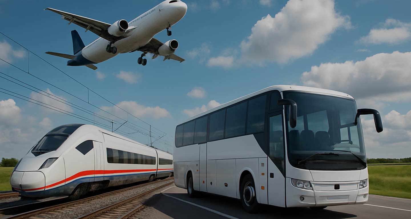
by Plane, Route or Car
Transport search
Transport search
To the map
To the review
[{"selectedTransportType":"car","routePoints":[{"latitude":-27.4360062,"longitude":151.7189067,"title":"Oakey"},{"latitude":-21.141956,"longitude":149.1865149,"title":"Mackay"}],"compositeRoutePoints":{"70f889cc2a914d7319965e98bce403fb":[{"transportType":"bus","startPoint":{"title":"Brisbane city","latitude":-27.464378,"longitude":153.01917},"endPoint":{"title":"Brisbane airport","latitude":-25.368347,"longitude":151.74004666666667},"routeStartPart":true},{"transportType":"plane","startPoint":{"title":"Brisbane airport","latitude":-25.368347,"longitude":151.74004666666667},"endPoint":{"title":"Mackay airport","latitude":-21.176285,"longitude":149.1818},"routeEndPart":true}],"0084773bfcda6466ac14355640d4b4e0":[{"transportType":"bus","startPoint":{"title":"Brisbane city","latitude":-27.464378,"longitude":153.01917},"endPoint":{"title":"Brisbane city","latitude":-25.368347,"longitude":151.74004666666667},"routeStartPart":true},{"transportType":"train","startPoint":{"title":"Brisbane city","latitude":-25.368347,"longitude":151.74004666666667},"endPoint":{"title":"Mackay airport","latitude":-21.176285,"longitude":149.1818},"routeEndPart":true}],"936f3033be8191cb014c0ac843180a01":[{"transportType":"bus","startPoint":{"title":"Brisbane city","latitude":-27.464378,"longitude":153.01917},"endPoint":{"title":"Rockhampton","latitude":-24.3203315,"longitude":151.100485},"routeStartPart":true},{"transportType":"bus","startPoint":{"title":"Rockhampton","latitude":-24.3203315,"longitude":151.100485},"endPoint":{"title":"Mackay airport","latitude":-21.176285,"longitude":149.1818},"routeEndPart":true}],"5c5efd3edd8c6018cc9908b088b13eea":[{"transportType":"bus","startPoint":{"title":"Brisbane city","latitude":-27.464378,"longitude":153.01917},"endPoint":{"title":"Brisbane airport","latitude":-25.368347,"longitude":151.74004666666667},"routeStartPart":true},{"transportType":"plane","startPoint":{"title":"Brisbane airport","latitude":-25.368347,"longitude":151.74004666666667},"endPoint":{"title":"Mackay airport","latitude":-21.176285,"longitude":149.1818},"routeEndPart":true}],"f4ccd3aacfad248642ad1f2b90526b97":[{"transportType":"bus","startPoint":{"title":"Brisbane city","latitude":-27.464378,"longitude":153.01917},"endPoint":{"title":"Airport","latitude":-25.368347,"longitude":151.74004666666667},"routeStartPart":true},{"transportType":"plane","startPoint":{"title":"Airport","latitude":-25.368347,"longitude":151.74004666666667},"endPoint":{"title":"Mackay airport","latitude":-21.176285,"longitude":149.1818},"routeEndPart":true}],"598ef634e5b7fb3e9381042fa626f7c4":[{"transportType":"bus","startPoint":{"title":"Brisbane city","latitude":-27.464378,"longitude":153.01917},"endPoint":{"title":"Brisbane airport","latitude":-25.368347,"longitude":151.74004666666667},"routeStartPart":true},{"transportType":"plane","startPoint":{"title":"Brisbane airport","latitude":-25.368347,"longitude":151.74004666666667},"endPoint":{"title":"Mackay airport","latitude":-21.176285,"longitude":149.1818},"routeEndPart":true}],"7389e864c751878f8268e521551c909b":[{"transportType":"bus","startPoint":{"title":"Brisbane city","latitude":-27.464378,"longitude":153.01917},"endPoint":{"title":"Brisbane","latitude":-24.3203315,"longitude":151.100485},"routeStartPart":true},{"transportType":"bus","startPoint":{"title":"Brisbane","latitude":-24.3203315,"longitude":151.100485},"endPoint":{"title":"Mackay airport","latitude":-21.176285,"longitude":149.1818},"routeEndPart":true}]},"transportTypes":{"car":{"title":"Car","color":"var(--color-transport-car)","icon":"\u003Ci class=\u0022icon iconmoon iconmoon-transport_car\u0022 style=\u0022color:var(--color-white)\u0022 aria-label=\u0027TRANSPORT_CAR\u0027\u003E\u003C\/i\u003E"},"taxi":{"title":"Taxi","color":"var(--color-transport-taxi)","icon":"\u003Ci class=\u0022icon iconmoon iconmoon-transport_taxi\u0022 style=\u0022color:var(--color-white)\u0022 aria-label=\u0027TRANSPORT_TAXI\u0027\u003E\u003C\/i\u003E"},"bus":{"title":"Bus","color":"var(--color-transport-bus)","icon":"\u003Ci class=\u0022icon iconmoon iconmoon-transport_bus\u0022 style=\u0022color:var(--color-white)\u0022 aria-label=\u0027TRANSPORT_BUS\u0027\u003E\u003C\/i\u003E"},"train":{"title":"Train","color":"var(--color-transport-train)","icon":"\u003Ci class=\u0022icon iconmoon iconmoon-transport_train\u0022 style=\u0022color:var(--color-white)\u0022 aria-label=\u0027TRANSPORT_TRAIN\u0027\u003E\u003C\/i\u003E"},"truck":{"title":"Truck","color":"var(--color-transport-truck)","icon":"\u003Ci class=\u0022icon iconmoon iconmoon-transport_truck\u0022 style=\u0022color:var(--color-white)\u0022 aria-label=\u0027TRANSPORT_TRUCK\u0027\u003E\u003C\/i\u003E"},"plane":{"title":"Plane","color":"var(--color-transport-plane)","icon":"\u003Ci class=\u0022icon iconmoon iconmoon-transport_plane\u0022 style=\u0022color:var(--color-white)\u0022 aria-label=\u0027TRANSPORT_PLANE\u0027\u003E\u003C\/i\u003E"},"ride_share":{"title":"Rideshare","color":"var(--color-transport-ride_share)","icon":"\u003Ci class=\u0022icon iconmoon iconmoon-transport_rideshare\u0022 style=\u0022color:var(--color-white)\u0022 aria-label=\u0027TRANSPORT_RIDE_SHARE\u0027\u003E\u003C\/i\u003E"},"people":{"title":"Person","color":"var(--color-transport-people)","icon":"\u003Ci class=\u0022icon iconmoon iconmoon-transport_people\u0022 style=\u0022color:var(--color-white)\u0022 aria-label=\u0027TRANSPORT_PEOPLE\u0027\u003E\u003C\/i\u003E"},"walk":{"title":"Walking","color":"var(--color-transport-walk)","icon":"\u003Ci class=\u0022icon iconmoon iconmoon-transport_walk\u0022 style=\u0022color:var(--color-white)\u0022 aria-label=\u0027TRANSPORT_WALK\u0027\u003E\u003C\/i\u003E"},"bike":{"title":"Bicycle","color":"var(--color-transport-bike)","icon":"\u003Ci class=\u0022icon iconmoon iconmoon-transport_bike\u0022 style=\u0022color:var(--color-white)\u0022 aria-label=\u0027TRANSPORT_BIKE\u0027\u003E\u003C\/i\u003E"},"transfer":{"title":"Transfer","color":"var(--color-transport-transfer)","icon":"\u003Ci class=\u0022icon iconmoon iconmoon-transport_transfer\u0022 style=\u0022color:var(--color-white)\u0022 aria-label=\u0027TRANSPORT_TRANSFER\u0027\u003E\u003C\/i\u003E"},"subway":{"title":"Subway","color":"var(--color-transport-subway)","icon":"\u003Ci class=\u0022icon iconmoon iconmoon-transport_subway\u0022 style=\u0022color:var(--color-white)\u0022 aria-label=\u0027TRANSPORT_SUBWAY\u0027\u003E\u003C\/i\u003E"},"composite":{"title":"Route","color":"var(--color-transport-composite)","icon":"\u003Ci class=\u0022icon iconmoon iconmoon-transport_transfer\u0022 style=\u0022color:var(--color-white)\u0022 aria-label=\u0027TRANSPORT_TRANSFER\u0027\u003E\u003C\/i\u003E"},"carsharing":{"title":"Carsharing","color":"var(--color-transport-carsharing)","icon":"\u003Ci class=\u0022icon iconmoon iconmoon-transport_carsharing\u0022 style=\u0022color:var(--color-white)\u0022 aria-label=\u0027TRANSPORT_CARSHARING\u0027\u003E\u003C\/i\u003E"},"suburban":{"title":"Electric Train","color":"var(--color-transport-suburban)","icon":"\u003Ci class=\u0022icon iconmoon iconmoon-transport_suburban\u0022 style=\u0022color:var(--color-white)\u0022 aria-label=\u0027TRANSPORT_SUBURBAN\u0027\u003E\u003C\/i\u003E"},"tram":{"title":"Tram","color":"var(--color-transport-tram)","icon":"\u003Ci class=\u0022icon iconmoon iconmoon-transport_transfer\u0022 style=\u0022color:var(--color-white)\u0022 aria-label=\u0027TRANSPORT_TRANSFER\u0027\u003E\u003C\/i\u003E"},"rail":{"title":"Rail","color":"var(--color-transport-rail)","icon":"\u003Ci class=\u0022icon iconmoon iconmoon-transport_train\u0022 style=\u0022color:var(--color-white)\u0022 aria-label=\u0027TRANSPORT_TRAIN\u0027\u003E\u003C\/i\u003E"},"ferry":{"title":"Ferry","color":"var(--color-transport-ferry)","icon":"\u003Ci class=\u0022icon iconmoon iconmoon-transport_transfer\u0022 style=\u0022color:var(--color-white)\u0022 aria-label=\u0027TRANSPORT_TRANSFER\u0027\u003E\u003C\/i\u003E"},"unknown":{"title":"Unknown","color":"var(--color-transport-unknown)","icon":"\u003Ci class=\u0022icon iconmoon iconmoon-transport_transfer\u0022 style=\u0022color:var(--color-white)\u0022 aria-label=\u0027TRANSPORT_TRANSFER\u0027\u003E\u003C\/i\u003E"}},"pointIcon":"\u003Ci class=\u0022icon iconmoon iconmoon-map_point\u0022 style=\u0022color:var(--color-primary)\u0022 aria-label=\u0027MAP_POINT\u0027\u003E\u003C\/i\u003E","routeId":44942039}, {"selectedTransportType":"plane","routePoints":[{"latitude":-27.4360062,"longitude":151.7189067,"title":"Oakey"},{"latitude":-21.141956,"longitude":149.1865149,"title":"Mackay"}],"compositeRoutePoints":{"70f889cc2a914d7319965e98bce403fb":[{"transportType":"bus","startPoint":{"title":"Brisbane city","latitude":-27.464378,"longitude":153.01917},"endPoint":{"title":"Brisbane airport","latitude":-25.368347,"longitude":151.74004666666667},"routeStartPart":true},{"transportType":"plane","startPoint":{"title":"Brisbane airport","latitude":-25.368347,"longitude":151.74004666666667},"endPoint":{"title":"Mackay airport","latitude":-21.176285,"longitude":149.1818},"routeEndPart":true}],"0084773bfcda6466ac14355640d4b4e0":[{"transportType":"bus","startPoint":{"title":"Brisbane city","latitude":-27.464378,"longitude":153.01917},"endPoint":{"title":"Brisbane city","latitude":-25.368347,"longitude":151.74004666666667},"routeStartPart":true},{"transportType":"train","startPoint":{"title":"Brisbane city","latitude":-25.368347,"longitude":151.74004666666667},"endPoint":{"title":"Mackay airport","latitude":-21.176285,"longitude":149.1818},"routeEndPart":true}],"936f3033be8191cb014c0ac843180a01":[{"transportType":"bus","startPoint":{"title":"Brisbane city","latitude":-27.464378,"longitude":153.01917},"endPoint":{"title":"Rockhampton","latitude":-24.3203315,"longitude":151.100485},"routeStartPart":true},{"transportType":"bus","startPoint":{"title":"Rockhampton","latitude":-24.3203315,"longitude":151.100485},"endPoint":{"title":"Mackay airport","latitude":-21.176285,"longitude":149.1818},"routeEndPart":true}],"5c5efd3edd8c6018cc9908b088b13eea":[{"transportType":"bus","startPoint":{"title":"Brisbane city","latitude":-27.464378,"longitude":153.01917},"endPoint":{"title":"Brisbane airport","latitude":-25.368347,"longitude":151.74004666666667},"routeStartPart":true},{"transportType":"plane","startPoint":{"title":"Brisbane airport","latitude":-25.368347,"longitude":151.74004666666667},"endPoint":{"title":"Mackay airport","latitude":-21.176285,"longitude":149.1818},"routeEndPart":true}],"f4ccd3aacfad248642ad1f2b90526b97":[{"transportType":"bus","startPoint":{"title":"Brisbane city","latitude":-27.464378,"longitude":153.01917},"endPoint":{"title":"Airport","latitude":-25.368347,"longitude":151.74004666666667},"routeStartPart":true},{"transportType":"plane","startPoint":{"title":"Airport","latitude":-25.368347,"longitude":151.74004666666667},"endPoint":{"title":"Mackay airport","latitude":-21.176285,"longitude":149.1818},"routeEndPart":true}],"598ef634e5b7fb3e9381042fa626f7c4":[{"transportType":"bus","startPoint":{"title":"Brisbane city","latitude":-27.464378,"longitude":153.01917},"endPoint":{"title":"Brisbane airport","latitude":-25.368347,"longitude":151.74004666666667},"routeStartPart":true},{"transportType":"plane","startPoint":{"title":"Brisbane airport","latitude":-25.368347,"longitude":151.74004666666667},"endPoint":{"title":"Mackay airport","latitude":-21.176285,"longitude":149.1818},"routeEndPart":true}],"7389e864c751878f8268e521551c909b":[{"transportType":"bus","startPoint":{"title":"Brisbane city","latitude":-27.464378,"longitude":153.01917},"endPoint":{"title":"Brisbane","latitude":-24.3203315,"longitude":151.100485},"routeStartPart":true},{"transportType":"bus","startPoint":{"title":"Brisbane","latitude":-24.3203315,"longitude":151.100485},"endPoint":{"title":"Mackay airport","latitude":-21.176285,"longitude":149.1818},"routeEndPart":true}]},"transportTypes":{"car":{"title":"Car","color":"var(--color-transport-car)","icon":"\u003Ci class=\u0022icon iconmoon iconmoon-transport_car\u0022 style=\u0022color:var(--color-white)\u0022 aria-label=\u0027TRANSPORT_CAR\u0027\u003E\u003C\/i\u003E"},"taxi":{"title":"Taxi","color":"var(--color-transport-taxi)","icon":"\u003Ci class=\u0022icon iconmoon iconmoon-transport_taxi\u0022 style=\u0022color:var(--color-white)\u0022 aria-label=\u0027TRANSPORT_TAXI\u0027\u003E\u003C\/i\u003E"},"bus":{"title":"Bus","color":"var(--color-transport-bus)","icon":"\u003Ci class=\u0022icon iconmoon iconmoon-transport_bus\u0022 style=\u0022color:var(--color-white)\u0022 aria-label=\u0027TRANSPORT_BUS\u0027\u003E\u003C\/i\u003E"},"train":{"title":"Train","color":"var(--color-transport-train)","icon":"\u003Ci class=\u0022icon iconmoon iconmoon-transport_train\u0022 style=\u0022color:var(--color-white)\u0022 aria-label=\u0027TRANSPORT_TRAIN\u0027\u003E\u003C\/i\u003E"},"truck":{"title":"Truck","color":"var(--color-transport-truck)","icon":"\u003Ci class=\u0022icon iconmoon iconmoon-transport_truck\u0022 style=\u0022color:var(--color-white)\u0022 aria-label=\u0027TRANSPORT_TRUCK\u0027\u003E\u003C\/i\u003E"},"plane":{"title":"Plane","color":"var(--color-transport-plane)","icon":"\u003Ci class=\u0022icon iconmoon iconmoon-transport_plane\u0022 style=\u0022color:var(--color-white)\u0022 aria-label=\u0027TRANSPORT_PLANE\u0027\u003E\u003C\/i\u003E"},"ride_share":{"title":"Rideshare","color":"var(--color-transport-ride_share)","icon":"\u003Ci class=\u0022icon iconmoon iconmoon-transport_rideshare\u0022 style=\u0022color:var(--color-white)\u0022 aria-label=\u0027TRANSPORT_RIDE_SHARE\u0027\u003E\u003C\/i\u003E"},"people":{"title":"Person","color":"var(--color-transport-people)","icon":"\u003Ci class=\u0022icon iconmoon iconmoon-transport_people\u0022 style=\u0022color:var(--color-white)\u0022 aria-label=\u0027TRANSPORT_PEOPLE\u0027\u003E\u003C\/i\u003E"},"walk":{"title":"Walking","color":"var(--color-transport-walk)","icon":"\u003Ci class=\u0022icon iconmoon iconmoon-transport_walk\u0022 style=\u0022color:var(--color-white)\u0022 aria-label=\u0027TRANSPORT_WALK\u0027\u003E\u003C\/i\u003E"},"bike":{"title":"Bicycle","color":"var(--color-transport-bike)","icon":"\u003Ci class=\u0022icon iconmoon iconmoon-transport_bike\u0022 style=\u0022color:var(--color-white)\u0022 aria-label=\u0027TRANSPORT_BIKE\u0027\u003E\u003C\/i\u003E"},"transfer":{"title":"Transfer","color":"var(--color-transport-transfer)","icon":"\u003Ci class=\u0022icon iconmoon iconmoon-transport_transfer\u0022 style=\u0022color:var(--color-white)\u0022 aria-label=\u0027TRANSPORT_TRANSFER\u0027\u003E\u003C\/i\u003E"},"subway":{"title":"Subway","color":"var(--color-transport-subway)","icon":"\u003Ci class=\u0022icon iconmoon iconmoon-transport_subway\u0022 style=\u0022color:var(--color-white)\u0022 aria-label=\u0027TRANSPORT_SUBWAY\u0027\u003E\u003C\/i\u003E"},"composite":{"title":"Route","color":"var(--color-transport-composite)","icon":"\u003Ci class=\u0022icon iconmoon iconmoon-transport_transfer\u0022 style=\u0022color:var(--color-white)\u0022 aria-label=\u0027TRANSPORT_TRANSFER\u0027\u003E\u003C\/i\u003E"},"carsharing":{"title":"Carsharing","color":"var(--color-transport-carsharing)","icon":"\u003Ci class=\u0022icon iconmoon iconmoon-transport_carsharing\u0022 style=\u0022color:var(--color-white)\u0022 aria-label=\u0027TRANSPORT_CARSHARING\u0027\u003E\u003C\/i\u003E"},"suburban":{"title":"Electric Train","color":"var(--color-transport-suburban)","icon":"\u003Ci class=\u0022icon iconmoon iconmoon-transport_suburban\u0022 style=\u0022color:var(--color-white)\u0022 aria-label=\u0027TRANSPORT_SUBURBAN\u0027\u003E\u003C\/i\u003E"},"tram":{"title":"Tram","color":"var(--color-transport-tram)","icon":"\u003Ci class=\u0022icon iconmoon iconmoon-transport_transfer\u0022 style=\u0022color:var(--color-white)\u0022 aria-label=\u0027TRANSPORT_TRANSFER\u0027\u003E\u003C\/i\u003E"},"rail":{"title":"Rail","color":"var(--color-transport-rail)","icon":"\u003Ci class=\u0022icon iconmoon iconmoon-transport_train\u0022 style=\u0022color:var(--color-white)\u0022 aria-label=\u0027TRANSPORT_TRAIN\u0027\u003E\u003C\/i\u003E"},"ferry":{"title":"Ferry","color":"var(--color-transport-ferry)","icon":"\u003Ci class=\u0022icon iconmoon iconmoon-transport_transfer\u0022 style=\u0022color:var(--color-white)\u0022 aria-label=\u0027TRANSPORT_TRANSFER\u0027\u003E\u003C\/i\u003E"},"unknown":{"title":"Unknown","color":"var(--color-transport-unknown)","icon":"\u003Ci class=\u0022icon iconmoon iconmoon-transport_transfer\u0022 style=\u0022color:var(--color-white)\u0022 aria-label=\u0027TRANSPORT_TRANSFER\u0027\u003E\u003C\/i\u003E"}},"pointIcon":"\u003Ci class=\u0022icon iconmoon iconmoon-map_point\u0022 style=\u0022color:var(--color-primary)\u0022 aria-label=\u0027MAP_POINT\u0027\u003E\u003C\/i\u003E","routeId":44942039}, {"selectedTransportType":"composite","routePoints":[{"latitude":-27.4360062,"longitude":151.7189067,"title":"Oakey"},{"latitude":-21.141956,"longitude":149.1865149,"title":"Mackay"}],"compositeRoutePoints":{"70f889cc2a914d7319965e98bce403fb":[{"transportType":"bus","startPoint":{"title":"Brisbane city","latitude":-27.464378,"longitude":153.01917},"endPoint":{"title":"Brisbane airport","latitude":-25.368347,"longitude":151.74004666666667},"routeStartPart":true},{"transportType":"plane","startPoint":{"title":"Brisbane airport","latitude":-25.368347,"longitude":151.74004666666667},"endPoint":{"title":"Mackay airport","latitude":-21.176285,"longitude":149.1818},"routeEndPart":true}],"0084773bfcda6466ac14355640d4b4e0":[{"transportType":"bus","startPoint":{"title":"Brisbane city","latitude":-27.464378,"longitude":153.01917},"endPoint":{"title":"Brisbane city","latitude":-25.368347,"longitude":151.74004666666667},"routeStartPart":true},{"transportType":"train","startPoint":{"title":"Brisbane city","latitude":-25.368347,"longitude":151.74004666666667},"endPoint":{"title":"Mackay airport","latitude":-21.176285,"longitude":149.1818},"routeEndPart":true}],"936f3033be8191cb014c0ac843180a01":[{"transportType":"bus","startPoint":{"title":"Brisbane city","latitude":-27.464378,"longitude":153.01917},"endPoint":{"title":"Rockhampton","latitude":-24.3203315,"longitude":151.100485},"routeStartPart":true},{"transportType":"bus","startPoint":{"title":"Rockhampton","latitude":-24.3203315,"longitude":151.100485},"endPoint":{"title":"Mackay airport","latitude":-21.176285,"longitude":149.1818},"routeEndPart":true}],"5c5efd3edd8c6018cc9908b088b13eea":[{"transportType":"bus","startPoint":{"title":"Brisbane city","latitude":-27.464378,"longitude":153.01917},"endPoint":{"title":"Brisbane airport","latitude":-25.368347,"longitude":151.74004666666667},"routeStartPart":true},{"transportType":"plane","startPoint":{"title":"Brisbane airport","latitude":-25.368347,"longitude":151.74004666666667},"endPoint":{"title":"Mackay airport","latitude":-21.176285,"longitude":149.1818},"routeEndPart":true}],"f4ccd3aacfad248642ad1f2b90526b97":[{"transportType":"bus","startPoint":{"title":"Brisbane city","latitude":-27.464378,"longitude":153.01917},"endPoint":{"title":"Airport","latitude":-25.368347,"longitude":151.74004666666667},"routeStartPart":true},{"transportType":"plane","startPoint":{"title":"Airport","latitude":-25.368347,"longitude":151.74004666666667},"endPoint":{"title":"Mackay airport","latitude":-21.176285,"longitude":149.1818},"routeEndPart":true}],"598ef634e5b7fb3e9381042fa626f7c4":[{"transportType":"bus","startPoint":{"title":"Brisbane city","latitude":-27.464378,"longitude":153.01917},"endPoint":{"title":"Brisbane airport","latitude":-25.368347,"longitude":151.74004666666667},"routeStartPart":true},{"transportType":"plane","startPoint":{"title":"Brisbane airport","latitude":-25.368347,"longitude":151.74004666666667},"endPoint":{"title":"Mackay airport","latitude":-21.176285,"longitude":149.1818},"routeEndPart":true}],"7389e864c751878f8268e521551c909b":[{"transportType":"bus","startPoint":{"title":"Brisbane city","latitude":-27.464378,"longitude":153.01917},"endPoint":{"title":"Brisbane","latitude":-24.3203315,"longitude":151.100485},"routeStartPart":true},{"transportType":"bus","startPoint":{"title":"Brisbane","latitude":-24.3203315,"longitude":151.100485},"endPoint":{"title":"Mackay airport","latitude":-21.176285,"longitude":149.1818},"routeEndPart":true}]},"transportTypes":{"car":{"title":"Car","color":"var(--color-transport-car)","icon":"\u003Ci class=\u0022icon iconmoon iconmoon-transport_car\u0022 style=\u0022color:var(--color-white)\u0022 aria-label=\u0027TRANSPORT_CAR\u0027\u003E\u003C\/i\u003E"},"taxi":{"title":"Taxi","color":"var(--color-transport-taxi)","icon":"\u003Ci class=\u0022icon iconmoon iconmoon-transport_taxi\u0022 style=\u0022color:var(--color-white)\u0022 aria-label=\u0027TRANSPORT_TAXI\u0027\u003E\u003C\/i\u003E"},"bus":{"title":"Bus","color":"var(--color-transport-bus)","icon":"\u003Ci class=\u0022icon iconmoon iconmoon-transport_bus\u0022 style=\u0022color:var(--color-white)\u0022 aria-label=\u0027TRANSPORT_BUS\u0027\u003E\u003C\/i\u003E"},"train":{"title":"Train","color":"var(--color-transport-train)","icon":"\u003Ci class=\u0022icon iconmoon iconmoon-transport_train\u0022 style=\u0022color:var(--color-white)\u0022 aria-label=\u0027TRANSPORT_TRAIN\u0027\u003E\u003C\/i\u003E"},"truck":{"title":"Truck","color":"var(--color-transport-truck)","icon":"\u003Ci class=\u0022icon iconmoon iconmoon-transport_truck\u0022 style=\u0022color:var(--color-white)\u0022 aria-label=\u0027TRANSPORT_TRUCK\u0027\u003E\u003C\/i\u003E"},"plane":{"title":"Plane","color":"var(--color-transport-plane)","icon":"\u003Ci class=\u0022icon iconmoon iconmoon-transport_plane\u0022 style=\u0022color:var(--color-white)\u0022 aria-label=\u0027TRANSPORT_PLANE\u0027\u003E\u003C\/i\u003E"},"ride_share":{"title":"Rideshare","color":"var(--color-transport-ride_share)","icon":"\u003Ci class=\u0022icon iconmoon iconmoon-transport_rideshare\u0022 style=\u0022color:var(--color-white)\u0022 aria-label=\u0027TRANSPORT_RIDE_SHARE\u0027\u003E\u003C\/i\u003E"},"people":{"title":"Person","color":"var(--color-transport-people)","icon":"\u003Ci class=\u0022icon iconmoon iconmoon-transport_people\u0022 style=\u0022color:var(--color-white)\u0022 aria-label=\u0027TRANSPORT_PEOPLE\u0027\u003E\u003C\/i\u003E"},"walk":{"title":"Walking","color":"var(--color-transport-walk)","icon":"\u003Ci class=\u0022icon iconmoon iconmoon-transport_walk\u0022 style=\u0022color:var(--color-white)\u0022 aria-label=\u0027TRANSPORT_WALK\u0027\u003E\u003C\/i\u003E"},"bike":{"title":"Bicycle","color":"var(--color-transport-bike)","icon":"\u003Ci class=\u0022icon iconmoon iconmoon-transport_bike\u0022 style=\u0022color:var(--color-white)\u0022 aria-label=\u0027TRANSPORT_BIKE\u0027\u003E\u003C\/i\u003E"},"transfer":{"title":"Transfer","color":"var(--color-transport-transfer)","icon":"\u003Ci class=\u0022icon iconmoon iconmoon-transport_transfer\u0022 style=\u0022color:var(--color-white)\u0022 aria-label=\u0027TRANSPORT_TRANSFER\u0027\u003E\u003C\/i\u003E"},"subway":{"title":"Subway","color":"var(--color-transport-subway)","icon":"\u003Ci class=\u0022icon iconmoon iconmoon-transport_subway\u0022 style=\u0022color:var(--color-white)\u0022 aria-label=\u0027TRANSPORT_SUBWAY\u0027\u003E\u003C\/i\u003E"},"composite":{"title":"Route","color":"var(--color-transport-composite)","icon":"\u003Ci class=\u0022icon iconmoon iconmoon-transport_transfer\u0022 style=\u0022color:var(--color-white)\u0022 aria-label=\u0027TRANSPORT_TRANSFER\u0027\u003E\u003C\/i\u003E"},"carsharing":{"title":"Carsharing","color":"var(--color-transport-carsharing)","icon":"\u003Ci class=\u0022icon iconmoon iconmoon-transport_carsharing\u0022 style=\u0022color:var(--color-white)\u0022 aria-label=\u0027TRANSPORT_CARSHARING\u0027\u003E\u003C\/i\u003E"},"suburban":{"title":"Electric Train","color":"var(--color-transport-suburban)","icon":"\u003Ci class=\u0022icon iconmoon iconmoon-transport_suburban\u0022 style=\u0022color:var(--color-white)\u0022 aria-label=\u0027TRANSPORT_SUBURBAN\u0027\u003E\u003C\/i\u003E"},"tram":{"title":"Tram","color":"var(--color-transport-tram)","icon":"\u003Ci class=\u0022icon iconmoon iconmoon-transport_transfer\u0022 style=\u0022color:var(--color-white)\u0022 aria-label=\u0027TRANSPORT_TRANSFER\u0027\u003E\u003C\/i\u003E"},"rail":{"title":"Rail","color":"var(--color-transport-rail)","icon":"\u003Ci class=\u0022icon iconmoon iconmoon-transport_train\u0022 style=\u0022color:var(--color-white)\u0022 aria-label=\u0027TRANSPORT_TRAIN\u0027\u003E\u003C\/i\u003E"},"ferry":{"title":"Ferry","color":"var(--color-transport-ferry)","icon":"\u003Ci class=\u0022icon iconmoon iconmoon-transport_transfer\u0022 style=\u0022color:var(--color-white)\u0022 aria-label=\u0027TRANSPORT_TRANSFER\u0027\u003E\u003C\/i\u003E"},"unknown":{"title":"Unknown","color":"var(--color-transport-unknown)","icon":"\u003Ci class=\u0022icon iconmoon iconmoon-transport_transfer\u0022 style=\u0022color:var(--color-white)\u0022 aria-label=\u0027TRANSPORT_TRANSFER\u0027\u003E\u003C\/i\u003E"}},"pointIcon":"\u003Ci class=\u0022icon iconmoon iconmoon-map_point\u0022 style=\u0022color:var(--color-primary)\u0022 aria-label=\u0027MAP_POINT\u0027\u003E\u003C\/i\u003E","routeId":44942039}]