How to Travel from
Aix-en-Provence to Poitiers
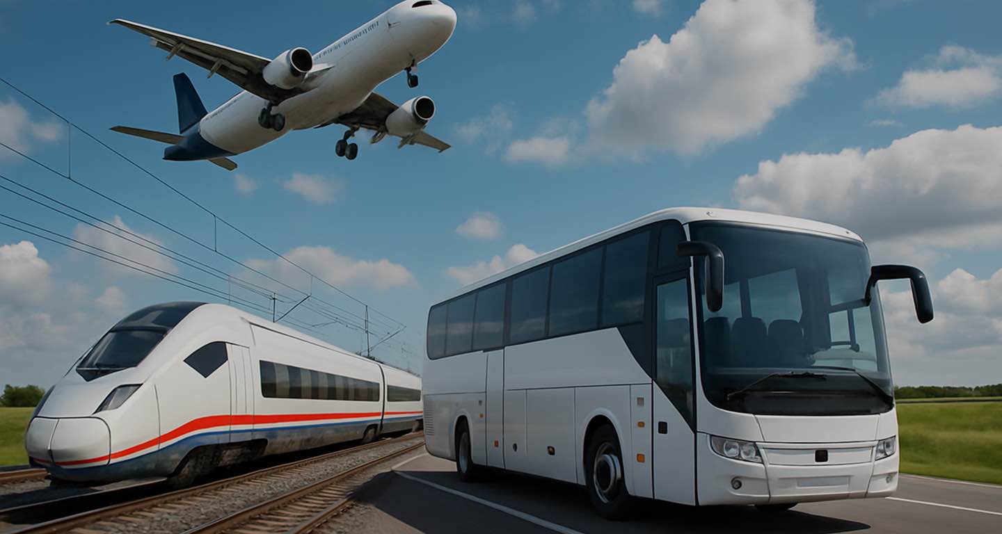
by Plane, Train, Rideshare, Route or Car
Transport search
Transport search
To the map
To the review
[{"selectedTransportType":"car","routePoints":[{"latitude":43.5283,"longitude":5.44973,"title":"Aix-en-Provence"},{"latitude":46.58333,"longitude":0.33333,"title":"Poitiers"}],"compositeRoutePoints":{"5f436e2808f71b5f46b0a14c8e6c5105":[{"transportType":"train","startPoint":{"title":"Gare aix tgv","latitude":43.45456,"longitude":5.316428},"endPoint":{"title":"Paris","latitude":46.148430000000005,"longitude":3.841018},"routeStartPart":true},{"transportType":"train","startPoint":{"title":"Paris","latitude":46.148430000000005,"longitude":3.841018},"endPoint":{"title":"Paris austerlitz","latitude":48.8423,"longitude":2.365608},"routeEndPart":true}],"f333666e6c7e80b278e15cc7e661bb30":[{"transportType":"bus","startPoint":{"title":"Gare aix tgv","latitude":43.45456,"longitude":5.316428},"endPoint":{"title":"Airport","latitude":45.25047333333333,"longitude":4.332821333333333},"routeStartPart":true},{"transportType":"plane","startPoint":{"title":"Airport","latitude":45.25047333333333,"longitude":4.332821333333333},"endPoint":{"title":"Paris austerlitz","latitude":48.8423,"longitude":2.365608},"routeEndPart":true}],"18cb8b357514a1f969200174030ad96a":[{"transportType":"bus","startPoint":{"title":"Gare aix tgv","latitude":43.45456,"longitude":5.316428},"endPoint":{"title":"Bordeaux","latitude":46.148430000000005,"longitude":3.841018},"routeStartPart":true},{"transportType":"bus","startPoint":{"title":"Bordeaux","latitude":46.148430000000005,"longitude":3.841018},"endPoint":{"title":"Paris austerlitz","latitude":48.8423,"longitude":2.365608},"routeEndPart":true}],"a4d02286f5c9c32128a227ecc350aaf0":[{"transportType":"bus","startPoint":{"title":"Gare aix tgv","latitude":43.45456,"longitude":5.316428},"endPoint":{"title":"Airport","latitude":45.25047333333333,"longitude":4.332821333333333},"routeStartPart":true},{"transportType":"plane","startPoint":{"title":"Airport","latitude":45.25047333333333,"longitude":4.332821333333333},"endPoint":{"title":"Paris austerlitz","latitude":48.8423,"longitude":2.365608},"routeEndPart":true}],"bd6f0043b490641d4a44433cacc424a0":[{"transportType":"train","startPoint":{"title":"Gare aix tgv","latitude":43.45456,"longitude":5.316428},"endPoint":{"title":"Marseille st charles","latitude":46.148430000000005,"longitude":3.841018},"routeStartPart":true},{"transportType":"train","startPoint":{"title":"Marseille st charles","latitude":46.148430000000005,"longitude":3.841018},"endPoint":{"title":"Paris austerlitz","latitude":48.8423,"longitude":2.365608},"routeEndPart":true}],"7cb97b94b50a89228a3e78ee67e80885":[{"transportType":"train","startPoint":{"title":"Gare aix tgv","latitude":43.45456,"longitude":5.316428},"endPoint":{"title":"Montauban","latitude":46.148430000000005,"longitude":3.841018},"routeStartPart":true},{"transportType":"train","startPoint":{"title":"Montauban","latitude":46.148430000000005,"longitude":3.841018},"endPoint":{"title":"Paris austerlitz","latitude":48.8423,"longitude":2.365608},"routeEndPart":true}],"e0d7bb25153f7aca78c39dab04a979d6":[{"transportType":"bus","startPoint":{"title":"Gare aix tgv","latitude":43.45456,"longitude":5.316428},"endPoint":{"title":"Bordeaux","latitude":46.148430000000005,"longitude":3.841018},"routeStartPart":true},{"transportType":"bus","startPoint":{"title":"Bordeaux","latitude":46.148430000000005,"longitude":3.841018},"endPoint":{"title":"Paris austerlitz","latitude":48.8423,"longitude":2.365608},"routeEndPart":true}],"d8e9d10d92f431311b77296fd815efe8":[{"transportType":"bus","startPoint":{"title":"Gare aix tgv","latitude":43.45456,"longitude":5.316428},"endPoint":{"title":"Airport","latitude":45.25047333333333,"longitude":4.332821333333333},"routeStartPart":true},{"transportType":"plane","startPoint":{"title":"Airport","latitude":45.25047333333333,"longitude":4.332821333333333},"endPoint":{"title":"Paris austerlitz","latitude":48.8423,"longitude":2.365608},"routeEndPart":true}],"0ad92f1ec8116cd8e8344d0b5c9a91ec":[{"transportType":"bus","startPoint":{"title":"Gare aix tgv","latitude":43.45456,"longitude":5.316428},"endPoint":{"title":"Airport","latitude":45.25047333333333,"longitude":4.332821333333333},"routeStartPart":true},{"transportType":"plane","startPoint":{"title":"Airport","latitude":45.25047333333333,"longitude":4.332821333333333},"endPoint":{"title":"Paris austerlitz","latitude":48.8423,"longitude":2.365608},"routeEndPart":true}],"883c546ff8c8502184db98957173265b":[{"transportType":"bus","startPoint":{"title":"Gare aix tgv","latitude":43.45456,"longitude":5.316428},"endPoint":{"title":"Airport","latitude":45.25047333333333,"longitude":4.332821333333333},"routeStartPart":true},{"transportType":"plane","startPoint":{"title":"Airport","latitude":45.25047333333333,"longitude":4.332821333333333},"endPoint":{"title":"Paris austerlitz","latitude":48.8423,"longitude":2.365608},"routeEndPart":true}]},"transportTypes":{"car":{"title":"Car","color":"var(--color-transport-car)","icon":"\u003Ci class=\u0022icon iconmoon iconmoon-transport_car\u0022 style=\u0022color:var(--color-white)\u0022 aria-label=\u0027TRANSPORT_CAR\u0027\u003E\u003C\/i\u003E"},"taxi":{"title":"Taxi","color":"var(--color-transport-taxi)","icon":"\u003Ci class=\u0022icon iconmoon iconmoon-transport_taxi\u0022 style=\u0022color:var(--color-white)\u0022 aria-label=\u0027TRANSPORT_TAXI\u0027\u003E\u003C\/i\u003E"},"bus":{"title":"Bus","color":"var(--color-transport-bus)","icon":"\u003Ci class=\u0022icon iconmoon iconmoon-transport_bus\u0022 style=\u0022color:var(--color-white)\u0022 aria-label=\u0027TRANSPORT_BUS\u0027\u003E\u003C\/i\u003E"},"train":{"title":"Train","color":"var(--color-transport-train)","icon":"\u003Ci class=\u0022icon iconmoon iconmoon-transport_train\u0022 style=\u0022color:var(--color-white)\u0022 aria-label=\u0027TRANSPORT_TRAIN\u0027\u003E\u003C\/i\u003E"},"truck":{"title":"Truck","color":"var(--color-transport-truck)","icon":"\u003Ci class=\u0022icon iconmoon iconmoon-transport_truck\u0022 style=\u0022color:var(--color-white)\u0022 aria-label=\u0027TRANSPORT_TRUCK\u0027\u003E\u003C\/i\u003E"},"plane":{"title":"Plane","color":"var(--color-transport-plane)","icon":"\u003Ci class=\u0022icon iconmoon iconmoon-transport_plane\u0022 style=\u0022color:var(--color-white)\u0022 aria-label=\u0027TRANSPORT_PLANE\u0027\u003E\u003C\/i\u003E"},"ride_share":{"title":"Rideshare","color":"var(--color-transport-ride_share)","icon":"\u003Ci class=\u0022icon iconmoon iconmoon-transport_rideshare\u0022 style=\u0022color:var(--color-white)\u0022 aria-label=\u0027TRANSPORT_RIDE_SHARE\u0027\u003E\u003C\/i\u003E"},"people":{"title":"Person","color":"var(--color-transport-people)","icon":"\u003Ci class=\u0022icon iconmoon iconmoon-transport_people\u0022 style=\u0022color:var(--color-white)\u0022 aria-label=\u0027TRANSPORT_PEOPLE\u0027\u003E\u003C\/i\u003E"},"walk":{"title":"Walking","color":"var(--color-transport-walk)","icon":"\u003Ci class=\u0022icon iconmoon iconmoon-transport_walk\u0022 style=\u0022color:var(--color-white)\u0022 aria-label=\u0027TRANSPORT_WALK\u0027\u003E\u003C\/i\u003E"},"bike":{"title":"Bicycle","color":"var(--color-transport-bike)","icon":"\u003Ci class=\u0022icon iconmoon iconmoon-transport_bike\u0022 style=\u0022color:var(--color-white)\u0022 aria-label=\u0027TRANSPORT_BIKE\u0027\u003E\u003C\/i\u003E"},"transfer":{"title":"Transfer","color":"var(--color-transport-transfer)","icon":"\u003Ci class=\u0022icon iconmoon iconmoon-transport_transfer\u0022 style=\u0022color:var(--color-white)\u0022 aria-label=\u0027TRANSPORT_TRANSFER\u0027\u003E\u003C\/i\u003E"},"subway":{"title":"Subway","color":"var(--color-transport-subway)","icon":"\u003Ci class=\u0022icon iconmoon iconmoon-transport_subway\u0022 style=\u0022color:var(--color-white)\u0022 aria-label=\u0027TRANSPORT_SUBWAY\u0027\u003E\u003C\/i\u003E"},"composite":{"title":"Route","color":"var(--color-transport-composite)","icon":"\u003Ci class=\u0022icon iconmoon iconmoon-transport_transfer\u0022 style=\u0022color:var(--color-white)\u0022 aria-label=\u0027TRANSPORT_TRANSFER\u0027\u003E\u003C\/i\u003E"},"carsharing":{"title":"Carsharing","color":"var(--color-transport-carsharing)","icon":"\u003Ci class=\u0022icon iconmoon iconmoon-transport_carsharing\u0022 style=\u0022color:var(--color-white)\u0022 aria-label=\u0027TRANSPORT_CARSHARING\u0027\u003E\u003C\/i\u003E"},"suburban":{"title":"Electric Train","color":"var(--color-transport-suburban)","icon":"\u003Ci class=\u0022icon iconmoon iconmoon-transport_suburban\u0022 style=\u0022color:var(--color-white)\u0022 aria-label=\u0027TRANSPORT_SUBURBAN\u0027\u003E\u003C\/i\u003E"},"tram":{"title":"Tram","color":"var(--color-transport-tram)","icon":"\u003Ci class=\u0022icon iconmoon iconmoon-transport_tram\u0022 style=\u0022color:var(--color-white)\u0022 aria-label=\u0027TRANSPORT_TRAM\u0027\u003E\u003C\/i\u003E"},"trolleybus":{"title":"Trolleybus","color":"var(--color-transport-trolleybus)","icon":"\u003Ci class=\u0022icon iconmoon iconmoon-transport_trolleybus\u0022 style=\u0022color:var(--color-white)\u0022 aria-label=\u0027TRANSPORT_TROLLEYBUS\u0027\u003E\u003C\/i\u003E"},"cable_car":{"title":"Funicular","color":"var(--color-transport-cable_car)","icon":"\u003Ci class=\u0022icon iconmoon iconmoon-transport_funicular\u0022 style=\u0022color:var(--color-white)\u0022 aria-label=\u0027TRANSPORT_CABLE_CAR\u0027\u003E\u003C\/i\u003E"},"rail":{"title":"Rail","color":"var(--color-transport-rail)","icon":"\u003Ci class=\u0022icon iconmoon iconmoon-transport_train\u0022 style=\u0022color:var(--color-white)\u0022 aria-label=\u0027TRANSPORT_TRAIN\u0027\u003E\u003C\/i\u003E"},"ferry":{"title":"Ferry","color":"var(--color-transport-ferry)","icon":"\u003Ci class=\u0022icon iconmoon iconmoon-transport_ferry\u0022 style=\u0022color:var(--color-white)\u0022 aria-label=\u0027TRANSPORT_FERRY\u0027\u003E\u003C\/i\u003E"},"rent":{"title":"Rent auto","color":"var(--color-transport-rent)","icon":"\u003Ci class=\u0022icon iconmoon iconmoon-transport_rent\u0022 style=\u0022color:var(--color-white)\u0022 aria-label=\u0027TRANSPORT_RENT\u0027\u003E\u003C\/i\u003E"},"unknown":{"title":"Unknown","color":"var(--color-transport-unknown)","icon":"\u003Ci class=\u0022icon iconmoon iconmoon-transport_transfer\u0022 style=\u0022color:var(--color-white)\u0022 aria-label=\u0027TRANSPORT_TRANSFER\u0027\u003E\u003C\/i\u003E"}},"pointIcon":"\u003Ci class=\u0022icon iconmoon iconmoon-map_point\u0022 style=\u0022color:var(--color-primary)\u0022 aria-label=\u0027MAP_POINT\u0027\u003E\u003C\/i\u003E","routeId":47832191}, {"selectedTransportType":"plane","routePoints":[{"latitude":43.5283,"longitude":5.44973,"title":"Aix-en-Provence"},{"latitude":46.58333,"longitude":0.33333,"title":"Poitiers"}],"compositeRoutePoints":{"5f436e2808f71b5f46b0a14c8e6c5105":[{"transportType":"train","startPoint":{"title":"Gare aix tgv","latitude":43.45456,"longitude":5.316428},"endPoint":{"title":"Paris","latitude":46.148430000000005,"longitude":3.841018},"routeStartPart":true},{"transportType":"train","startPoint":{"title":"Paris","latitude":46.148430000000005,"longitude":3.841018},"endPoint":{"title":"Paris austerlitz","latitude":48.8423,"longitude":2.365608},"routeEndPart":true}],"f333666e6c7e80b278e15cc7e661bb30":[{"transportType":"bus","startPoint":{"title":"Gare aix tgv","latitude":43.45456,"longitude":5.316428},"endPoint":{"title":"Airport","latitude":45.25047333333333,"longitude":4.332821333333333},"routeStartPart":true},{"transportType":"plane","startPoint":{"title":"Airport","latitude":45.25047333333333,"longitude":4.332821333333333},"endPoint":{"title":"Paris austerlitz","latitude":48.8423,"longitude":2.365608},"routeEndPart":true}],"18cb8b357514a1f969200174030ad96a":[{"transportType":"bus","startPoint":{"title":"Gare aix tgv","latitude":43.45456,"longitude":5.316428},"endPoint":{"title":"Bordeaux","latitude":46.148430000000005,"longitude":3.841018},"routeStartPart":true},{"transportType":"bus","startPoint":{"title":"Bordeaux","latitude":46.148430000000005,"longitude":3.841018},"endPoint":{"title":"Paris austerlitz","latitude":48.8423,"longitude":2.365608},"routeEndPart":true}],"a4d02286f5c9c32128a227ecc350aaf0":[{"transportType":"bus","startPoint":{"title":"Gare aix tgv","latitude":43.45456,"longitude":5.316428},"endPoint":{"title":"Airport","latitude":45.25047333333333,"longitude":4.332821333333333},"routeStartPart":true},{"transportType":"plane","startPoint":{"title":"Airport","latitude":45.25047333333333,"longitude":4.332821333333333},"endPoint":{"title":"Paris austerlitz","latitude":48.8423,"longitude":2.365608},"routeEndPart":true}],"bd6f0043b490641d4a44433cacc424a0":[{"transportType":"train","startPoint":{"title":"Gare aix tgv","latitude":43.45456,"longitude":5.316428},"endPoint":{"title":"Marseille st charles","latitude":46.148430000000005,"longitude":3.841018},"routeStartPart":true},{"transportType":"train","startPoint":{"title":"Marseille st charles","latitude":46.148430000000005,"longitude":3.841018},"endPoint":{"title":"Paris austerlitz","latitude":48.8423,"longitude":2.365608},"routeEndPart":true}],"7cb97b94b50a89228a3e78ee67e80885":[{"transportType":"train","startPoint":{"title":"Gare aix tgv","latitude":43.45456,"longitude":5.316428},"endPoint":{"title":"Montauban","latitude":46.148430000000005,"longitude":3.841018},"routeStartPart":true},{"transportType":"train","startPoint":{"title":"Montauban","latitude":46.148430000000005,"longitude":3.841018},"endPoint":{"title":"Paris austerlitz","latitude":48.8423,"longitude":2.365608},"routeEndPart":true}],"e0d7bb25153f7aca78c39dab04a979d6":[{"transportType":"bus","startPoint":{"title":"Gare aix tgv","latitude":43.45456,"longitude":5.316428},"endPoint":{"title":"Bordeaux","latitude":46.148430000000005,"longitude":3.841018},"routeStartPart":true},{"transportType":"bus","startPoint":{"title":"Bordeaux","latitude":46.148430000000005,"longitude":3.841018},"endPoint":{"title":"Paris austerlitz","latitude":48.8423,"longitude":2.365608},"routeEndPart":true}],"d8e9d10d92f431311b77296fd815efe8":[{"transportType":"bus","startPoint":{"title":"Gare aix tgv","latitude":43.45456,"longitude":5.316428},"endPoint":{"title":"Airport","latitude":45.25047333333333,"longitude":4.332821333333333},"routeStartPart":true},{"transportType":"plane","startPoint":{"title":"Airport","latitude":45.25047333333333,"longitude":4.332821333333333},"endPoint":{"title":"Paris austerlitz","latitude":48.8423,"longitude":2.365608},"routeEndPart":true}],"0ad92f1ec8116cd8e8344d0b5c9a91ec":[{"transportType":"bus","startPoint":{"title":"Gare aix tgv","latitude":43.45456,"longitude":5.316428},"endPoint":{"title":"Airport","latitude":45.25047333333333,"longitude":4.332821333333333},"routeStartPart":true},{"transportType":"plane","startPoint":{"title":"Airport","latitude":45.25047333333333,"longitude":4.332821333333333},"endPoint":{"title":"Paris austerlitz","latitude":48.8423,"longitude":2.365608},"routeEndPart":true}],"883c546ff8c8502184db98957173265b":[{"transportType":"bus","startPoint":{"title":"Gare aix tgv","latitude":43.45456,"longitude":5.316428},"endPoint":{"title":"Airport","latitude":45.25047333333333,"longitude":4.332821333333333},"routeStartPart":true},{"transportType":"plane","startPoint":{"title":"Airport","latitude":45.25047333333333,"longitude":4.332821333333333},"endPoint":{"title":"Paris austerlitz","latitude":48.8423,"longitude":2.365608},"routeEndPart":true}]},"transportTypes":{"car":{"title":"Car","color":"var(--color-transport-car)","icon":"\u003Ci class=\u0022icon iconmoon iconmoon-transport_car\u0022 style=\u0022color:var(--color-white)\u0022 aria-label=\u0027TRANSPORT_CAR\u0027\u003E\u003C\/i\u003E"},"taxi":{"title":"Taxi","color":"var(--color-transport-taxi)","icon":"\u003Ci class=\u0022icon iconmoon iconmoon-transport_taxi\u0022 style=\u0022color:var(--color-white)\u0022 aria-label=\u0027TRANSPORT_TAXI\u0027\u003E\u003C\/i\u003E"},"bus":{"title":"Bus","color":"var(--color-transport-bus)","icon":"\u003Ci class=\u0022icon iconmoon iconmoon-transport_bus\u0022 style=\u0022color:var(--color-white)\u0022 aria-label=\u0027TRANSPORT_BUS\u0027\u003E\u003C\/i\u003E"},"train":{"title":"Train","color":"var(--color-transport-train)","icon":"\u003Ci class=\u0022icon iconmoon iconmoon-transport_train\u0022 style=\u0022color:var(--color-white)\u0022 aria-label=\u0027TRANSPORT_TRAIN\u0027\u003E\u003C\/i\u003E"},"truck":{"title":"Truck","color":"var(--color-transport-truck)","icon":"\u003Ci class=\u0022icon iconmoon iconmoon-transport_truck\u0022 style=\u0022color:var(--color-white)\u0022 aria-label=\u0027TRANSPORT_TRUCK\u0027\u003E\u003C\/i\u003E"},"plane":{"title":"Plane","color":"var(--color-transport-plane)","icon":"\u003Ci class=\u0022icon iconmoon iconmoon-transport_plane\u0022 style=\u0022color:var(--color-white)\u0022 aria-label=\u0027TRANSPORT_PLANE\u0027\u003E\u003C\/i\u003E"},"ride_share":{"title":"Rideshare","color":"var(--color-transport-ride_share)","icon":"\u003Ci class=\u0022icon iconmoon iconmoon-transport_rideshare\u0022 style=\u0022color:var(--color-white)\u0022 aria-label=\u0027TRANSPORT_RIDE_SHARE\u0027\u003E\u003C\/i\u003E"},"people":{"title":"Person","color":"var(--color-transport-people)","icon":"\u003Ci class=\u0022icon iconmoon iconmoon-transport_people\u0022 style=\u0022color:var(--color-white)\u0022 aria-label=\u0027TRANSPORT_PEOPLE\u0027\u003E\u003C\/i\u003E"},"walk":{"title":"Walking","color":"var(--color-transport-walk)","icon":"\u003Ci class=\u0022icon iconmoon iconmoon-transport_walk\u0022 style=\u0022color:var(--color-white)\u0022 aria-label=\u0027TRANSPORT_WALK\u0027\u003E\u003C\/i\u003E"},"bike":{"title":"Bicycle","color":"var(--color-transport-bike)","icon":"\u003Ci class=\u0022icon iconmoon iconmoon-transport_bike\u0022 style=\u0022color:var(--color-white)\u0022 aria-label=\u0027TRANSPORT_BIKE\u0027\u003E\u003C\/i\u003E"},"transfer":{"title":"Transfer","color":"var(--color-transport-transfer)","icon":"\u003Ci class=\u0022icon iconmoon iconmoon-transport_transfer\u0022 style=\u0022color:var(--color-white)\u0022 aria-label=\u0027TRANSPORT_TRANSFER\u0027\u003E\u003C\/i\u003E"},"subway":{"title":"Subway","color":"var(--color-transport-subway)","icon":"\u003Ci class=\u0022icon iconmoon iconmoon-transport_subway\u0022 style=\u0022color:var(--color-white)\u0022 aria-label=\u0027TRANSPORT_SUBWAY\u0027\u003E\u003C\/i\u003E"},"composite":{"title":"Route","color":"var(--color-transport-composite)","icon":"\u003Ci class=\u0022icon iconmoon iconmoon-transport_transfer\u0022 style=\u0022color:var(--color-white)\u0022 aria-label=\u0027TRANSPORT_TRANSFER\u0027\u003E\u003C\/i\u003E"},"carsharing":{"title":"Carsharing","color":"var(--color-transport-carsharing)","icon":"\u003Ci class=\u0022icon iconmoon iconmoon-transport_carsharing\u0022 style=\u0022color:var(--color-white)\u0022 aria-label=\u0027TRANSPORT_CARSHARING\u0027\u003E\u003C\/i\u003E"},"suburban":{"title":"Electric Train","color":"var(--color-transport-suburban)","icon":"\u003Ci class=\u0022icon iconmoon iconmoon-transport_suburban\u0022 style=\u0022color:var(--color-white)\u0022 aria-label=\u0027TRANSPORT_SUBURBAN\u0027\u003E\u003C\/i\u003E"},"tram":{"title":"Tram","color":"var(--color-transport-tram)","icon":"\u003Ci class=\u0022icon iconmoon iconmoon-transport_tram\u0022 style=\u0022color:var(--color-white)\u0022 aria-label=\u0027TRANSPORT_TRAM\u0027\u003E\u003C\/i\u003E"},"trolleybus":{"title":"Trolleybus","color":"var(--color-transport-trolleybus)","icon":"\u003Ci class=\u0022icon iconmoon iconmoon-transport_trolleybus\u0022 style=\u0022color:var(--color-white)\u0022 aria-label=\u0027TRANSPORT_TROLLEYBUS\u0027\u003E\u003C\/i\u003E"},"cable_car":{"title":"Funicular","color":"var(--color-transport-cable_car)","icon":"\u003Ci class=\u0022icon iconmoon iconmoon-transport_funicular\u0022 style=\u0022color:var(--color-white)\u0022 aria-label=\u0027TRANSPORT_CABLE_CAR\u0027\u003E\u003C\/i\u003E"},"rail":{"title":"Rail","color":"var(--color-transport-rail)","icon":"\u003Ci class=\u0022icon iconmoon iconmoon-transport_train\u0022 style=\u0022color:var(--color-white)\u0022 aria-label=\u0027TRANSPORT_TRAIN\u0027\u003E\u003C\/i\u003E"},"ferry":{"title":"Ferry","color":"var(--color-transport-ferry)","icon":"\u003Ci class=\u0022icon iconmoon iconmoon-transport_ferry\u0022 style=\u0022color:var(--color-white)\u0022 aria-label=\u0027TRANSPORT_FERRY\u0027\u003E\u003C\/i\u003E"},"rent":{"title":"Rent auto","color":"var(--color-transport-rent)","icon":"\u003Ci class=\u0022icon iconmoon iconmoon-transport_rent\u0022 style=\u0022color:var(--color-white)\u0022 aria-label=\u0027TRANSPORT_RENT\u0027\u003E\u003C\/i\u003E"},"unknown":{"title":"Unknown","color":"var(--color-transport-unknown)","icon":"\u003Ci class=\u0022icon iconmoon iconmoon-transport_transfer\u0022 style=\u0022color:var(--color-white)\u0022 aria-label=\u0027TRANSPORT_TRANSFER\u0027\u003E\u003C\/i\u003E"}},"pointIcon":"\u003Ci class=\u0022icon iconmoon iconmoon-map_point\u0022 style=\u0022color:var(--color-primary)\u0022 aria-label=\u0027MAP_POINT\u0027\u003E\u003C\/i\u003E","routeId":47832191}, {"selectedTransportType":"train","routePoints":[{"latitude":43.5283,"longitude":5.44973,"title":"Aix-en-Provence"},{"latitude":46.58333,"longitude":0.33333,"title":"Poitiers"}],"compositeRoutePoints":{"5f436e2808f71b5f46b0a14c8e6c5105":[{"transportType":"train","startPoint":{"title":"Gare aix tgv","latitude":43.45456,"longitude":5.316428},"endPoint":{"title":"Paris","latitude":46.148430000000005,"longitude":3.841018},"routeStartPart":true},{"transportType":"train","startPoint":{"title":"Paris","latitude":46.148430000000005,"longitude":3.841018},"endPoint":{"title":"Paris austerlitz","latitude":48.8423,"longitude":2.365608},"routeEndPart":true}],"f333666e6c7e80b278e15cc7e661bb30":[{"transportType":"bus","startPoint":{"title":"Gare aix tgv","latitude":43.45456,"longitude":5.316428},"endPoint":{"title":"Airport","latitude":45.25047333333333,"longitude":4.332821333333333},"routeStartPart":true},{"transportType":"plane","startPoint":{"title":"Airport","latitude":45.25047333333333,"longitude":4.332821333333333},"endPoint":{"title":"Paris austerlitz","latitude":48.8423,"longitude":2.365608},"routeEndPart":true}],"18cb8b357514a1f969200174030ad96a":[{"transportType":"bus","startPoint":{"title":"Gare aix tgv","latitude":43.45456,"longitude":5.316428},"endPoint":{"title":"Bordeaux","latitude":46.148430000000005,"longitude":3.841018},"routeStartPart":true},{"transportType":"bus","startPoint":{"title":"Bordeaux","latitude":46.148430000000005,"longitude":3.841018},"endPoint":{"title":"Paris austerlitz","latitude":48.8423,"longitude":2.365608},"routeEndPart":true}],"a4d02286f5c9c32128a227ecc350aaf0":[{"transportType":"bus","startPoint":{"title":"Gare aix tgv","latitude":43.45456,"longitude":5.316428},"endPoint":{"title":"Airport","latitude":45.25047333333333,"longitude":4.332821333333333},"routeStartPart":true},{"transportType":"plane","startPoint":{"title":"Airport","latitude":45.25047333333333,"longitude":4.332821333333333},"endPoint":{"title":"Paris austerlitz","latitude":48.8423,"longitude":2.365608},"routeEndPart":true}],"bd6f0043b490641d4a44433cacc424a0":[{"transportType":"train","startPoint":{"title":"Gare aix tgv","latitude":43.45456,"longitude":5.316428},"endPoint":{"title":"Marseille st charles","latitude":46.148430000000005,"longitude":3.841018},"routeStartPart":true},{"transportType":"train","startPoint":{"title":"Marseille st charles","latitude":46.148430000000005,"longitude":3.841018},"endPoint":{"title":"Paris austerlitz","latitude":48.8423,"longitude":2.365608},"routeEndPart":true}],"7cb97b94b50a89228a3e78ee67e80885":[{"transportType":"train","startPoint":{"title":"Gare aix tgv","latitude":43.45456,"longitude":5.316428},"endPoint":{"title":"Montauban","latitude":46.148430000000005,"longitude":3.841018},"routeStartPart":true},{"transportType":"train","startPoint":{"title":"Montauban","latitude":46.148430000000005,"longitude":3.841018},"endPoint":{"title":"Paris austerlitz","latitude":48.8423,"longitude":2.365608},"routeEndPart":true}],"e0d7bb25153f7aca78c39dab04a979d6":[{"transportType":"bus","startPoint":{"title":"Gare aix tgv","latitude":43.45456,"longitude":5.316428},"endPoint":{"title":"Bordeaux","latitude":46.148430000000005,"longitude":3.841018},"routeStartPart":true},{"transportType":"bus","startPoint":{"title":"Bordeaux","latitude":46.148430000000005,"longitude":3.841018},"endPoint":{"title":"Paris austerlitz","latitude":48.8423,"longitude":2.365608},"routeEndPart":true}],"d8e9d10d92f431311b77296fd815efe8":[{"transportType":"bus","startPoint":{"title":"Gare aix tgv","latitude":43.45456,"longitude":5.316428},"endPoint":{"title":"Airport","latitude":45.25047333333333,"longitude":4.332821333333333},"routeStartPart":true},{"transportType":"plane","startPoint":{"title":"Airport","latitude":45.25047333333333,"longitude":4.332821333333333},"endPoint":{"title":"Paris austerlitz","latitude":48.8423,"longitude":2.365608},"routeEndPart":true}],"0ad92f1ec8116cd8e8344d0b5c9a91ec":[{"transportType":"bus","startPoint":{"title":"Gare aix tgv","latitude":43.45456,"longitude":5.316428},"endPoint":{"title":"Airport","latitude":45.25047333333333,"longitude":4.332821333333333},"routeStartPart":true},{"transportType":"plane","startPoint":{"title":"Airport","latitude":45.25047333333333,"longitude":4.332821333333333},"endPoint":{"title":"Paris austerlitz","latitude":48.8423,"longitude":2.365608},"routeEndPart":true}],"883c546ff8c8502184db98957173265b":[{"transportType":"bus","startPoint":{"title":"Gare aix tgv","latitude":43.45456,"longitude":5.316428},"endPoint":{"title":"Airport","latitude":45.25047333333333,"longitude":4.332821333333333},"routeStartPart":true},{"transportType":"plane","startPoint":{"title":"Airport","latitude":45.25047333333333,"longitude":4.332821333333333},"endPoint":{"title":"Paris austerlitz","latitude":48.8423,"longitude":2.365608},"routeEndPart":true}]},"transportTypes":{"car":{"title":"Car","color":"var(--color-transport-car)","icon":"\u003Ci class=\u0022icon iconmoon iconmoon-transport_car\u0022 style=\u0022color:var(--color-white)\u0022 aria-label=\u0027TRANSPORT_CAR\u0027\u003E\u003C\/i\u003E"},"taxi":{"title":"Taxi","color":"var(--color-transport-taxi)","icon":"\u003Ci class=\u0022icon iconmoon iconmoon-transport_taxi\u0022 style=\u0022color:var(--color-white)\u0022 aria-label=\u0027TRANSPORT_TAXI\u0027\u003E\u003C\/i\u003E"},"bus":{"title":"Bus","color":"var(--color-transport-bus)","icon":"\u003Ci class=\u0022icon iconmoon iconmoon-transport_bus\u0022 style=\u0022color:var(--color-white)\u0022 aria-label=\u0027TRANSPORT_BUS\u0027\u003E\u003C\/i\u003E"},"train":{"title":"Train","color":"var(--color-transport-train)","icon":"\u003Ci class=\u0022icon iconmoon iconmoon-transport_train\u0022 style=\u0022color:var(--color-white)\u0022 aria-label=\u0027TRANSPORT_TRAIN\u0027\u003E\u003C\/i\u003E"},"truck":{"title":"Truck","color":"var(--color-transport-truck)","icon":"\u003Ci class=\u0022icon iconmoon iconmoon-transport_truck\u0022 style=\u0022color:var(--color-white)\u0022 aria-label=\u0027TRANSPORT_TRUCK\u0027\u003E\u003C\/i\u003E"},"plane":{"title":"Plane","color":"var(--color-transport-plane)","icon":"\u003Ci class=\u0022icon iconmoon iconmoon-transport_plane\u0022 style=\u0022color:var(--color-white)\u0022 aria-label=\u0027TRANSPORT_PLANE\u0027\u003E\u003C\/i\u003E"},"ride_share":{"title":"Rideshare","color":"var(--color-transport-ride_share)","icon":"\u003Ci class=\u0022icon iconmoon iconmoon-transport_rideshare\u0022 style=\u0022color:var(--color-white)\u0022 aria-label=\u0027TRANSPORT_RIDE_SHARE\u0027\u003E\u003C\/i\u003E"},"people":{"title":"Person","color":"var(--color-transport-people)","icon":"\u003Ci class=\u0022icon iconmoon iconmoon-transport_people\u0022 style=\u0022color:var(--color-white)\u0022 aria-label=\u0027TRANSPORT_PEOPLE\u0027\u003E\u003C\/i\u003E"},"walk":{"title":"Walking","color":"var(--color-transport-walk)","icon":"\u003Ci class=\u0022icon iconmoon iconmoon-transport_walk\u0022 style=\u0022color:var(--color-white)\u0022 aria-label=\u0027TRANSPORT_WALK\u0027\u003E\u003C\/i\u003E"},"bike":{"title":"Bicycle","color":"var(--color-transport-bike)","icon":"\u003Ci class=\u0022icon iconmoon iconmoon-transport_bike\u0022 style=\u0022color:var(--color-white)\u0022 aria-label=\u0027TRANSPORT_BIKE\u0027\u003E\u003C\/i\u003E"},"transfer":{"title":"Transfer","color":"var(--color-transport-transfer)","icon":"\u003Ci class=\u0022icon iconmoon iconmoon-transport_transfer\u0022 style=\u0022color:var(--color-white)\u0022 aria-label=\u0027TRANSPORT_TRANSFER\u0027\u003E\u003C\/i\u003E"},"subway":{"title":"Subway","color":"var(--color-transport-subway)","icon":"\u003Ci class=\u0022icon iconmoon iconmoon-transport_subway\u0022 style=\u0022color:var(--color-white)\u0022 aria-label=\u0027TRANSPORT_SUBWAY\u0027\u003E\u003C\/i\u003E"},"composite":{"title":"Route","color":"var(--color-transport-composite)","icon":"\u003Ci class=\u0022icon iconmoon iconmoon-transport_transfer\u0022 style=\u0022color:var(--color-white)\u0022 aria-label=\u0027TRANSPORT_TRANSFER\u0027\u003E\u003C\/i\u003E"},"carsharing":{"title":"Carsharing","color":"var(--color-transport-carsharing)","icon":"\u003Ci class=\u0022icon iconmoon iconmoon-transport_carsharing\u0022 style=\u0022color:var(--color-white)\u0022 aria-label=\u0027TRANSPORT_CARSHARING\u0027\u003E\u003C\/i\u003E"},"suburban":{"title":"Electric Train","color":"var(--color-transport-suburban)","icon":"\u003Ci class=\u0022icon iconmoon iconmoon-transport_suburban\u0022 style=\u0022color:var(--color-white)\u0022 aria-label=\u0027TRANSPORT_SUBURBAN\u0027\u003E\u003C\/i\u003E"},"tram":{"title":"Tram","color":"var(--color-transport-tram)","icon":"\u003Ci class=\u0022icon iconmoon iconmoon-transport_tram\u0022 style=\u0022color:var(--color-white)\u0022 aria-label=\u0027TRANSPORT_TRAM\u0027\u003E\u003C\/i\u003E"},"trolleybus":{"title":"Trolleybus","color":"var(--color-transport-trolleybus)","icon":"\u003Ci class=\u0022icon iconmoon iconmoon-transport_trolleybus\u0022 style=\u0022color:var(--color-white)\u0022 aria-label=\u0027TRANSPORT_TROLLEYBUS\u0027\u003E\u003C\/i\u003E"},"cable_car":{"title":"Funicular","color":"var(--color-transport-cable_car)","icon":"\u003Ci class=\u0022icon iconmoon iconmoon-transport_funicular\u0022 style=\u0022color:var(--color-white)\u0022 aria-label=\u0027TRANSPORT_CABLE_CAR\u0027\u003E\u003C\/i\u003E"},"rail":{"title":"Rail","color":"var(--color-transport-rail)","icon":"\u003Ci class=\u0022icon iconmoon iconmoon-transport_train\u0022 style=\u0022color:var(--color-white)\u0022 aria-label=\u0027TRANSPORT_TRAIN\u0027\u003E\u003C\/i\u003E"},"ferry":{"title":"Ferry","color":"var(--color-transport-ferry)","icon":"\u003Ci class=\u0022icon iconmoon iconmoon-transport_ferry\u0022 style=\u0022color:var(--color-white)\u0022 aria-label=\u0027TRANSPORT_FERRY\u0027\u003E\u003C\/i\u003E"},"rent":{"title":"Rent auto","color":"var(--color-transport-rent)","icon":"\u003Ci class=\u0022icon iconmoon iconmoon-transport_rent\u0022 style=\u0022color:var(--color-white)\u0022 aria-label=\u0027TRANSPORT_RENT\u0027\u003E\u003C\/i\u003E"},"unknown":{"title":"Unknown","color":"var(--color-transport-unknown)","icon":"\u003Ci class=\u0022icon iconmoon iconmoon-transport_transfer\u0022 style=\u0022color:var(--color-white)\u0022 aria-label=\u0027TRANSPORT_TRANSFER\u0027\u003E\u003C\/i\u003E"}},"pointIcon":"\u003Ci class=\u0022icon iconmoon iconmoon-map_point\u0022 style=\u0022color:var(--color-primary)\u0022 aria-label=\u0027MAP_POINT\u0027\u003E\u003C\/i\u003E","routeId":47832191}, {"selectedTransportType":"ride_share","routePoints":[{"latitude":43.5283,"longitude":5.44973,"title":"Aix-en-Provence"},{"latitude":46.58333,"longitude":0.33333,"title":"Poitiers"}],"compositeRoutePoints":{"5f436e2808f71b5f46b0a14c8e6c5105":[{"transportType":"train","startPoint":{"title":"Gare aix tgv","latitude":43.45456,"longitude":5.316428},"endPoint":{"title":"Paris","latitude":46.148430000000005,"longitude":3.841018},"routeStartPart":true},{"transportType":"train","startPoint":{"title":"Paris","latitude":46.148430000000005,"longitude":3.841018},"endPoint":{"title":"Paris austerlitz","latitude":48.8423,"longitude":2.365608},"routeEndPart":true}],"f333666e6c7e80b278e15cc7e661bb30":[{"transportType":"bus","startPoint":{"title":"Gare aix tgv","latitude":43.45456,"longitude":5.316428},"endPoint":{"title":"Airport","latitude":45.25047333333333,"longitude":4.332821333333333},"routeStartPart":true},{"transportType":"plane","startPoint":{"title":"Airport","latitude":45.25047333333333,"longitude":4.332821333333333},"endPoint":{"title":"Paris austerlitz","latitude":48.8423,"longitude":2.365608},"routeEndPart":true}],"18cb8b357514a1f969200174030ad96a":[{"transportType":"bus","startPoint":{"title":"Gare aix tgv","latitude":43.45456,"longitude":5.316428},"endPoint":{"title":"Bordeaux","latitude":46.148430000000005,"longitude":3.841018},"routeStartPart":true},{"transportType":"bus","startPoint":{"title":"Bordeaux","latitude":46.148430000000005,"longitude":3.841018},"endPoint":{"title":"Paris austerlitz","latitude":48.8423,"longitude":2.365608},"routeEndPart":true}],"a4d02286f5c9c32128a227ecc350aaf0":[{"transportType":"bus","startPoint":{"title":"Gare aix tgv","latitude":43.45456,"longitude":5.316428},"endPoint":{"title":"Airport","latitude":45.25047333333333,"longitude":4.332821333333333},"routeStartPart":true},{"transportType":"plane","startPoint":{"title":"Airport","latitude":45.25047333333333,"longitude":4.332821333333333},"endPoint":{"title":"Paris austerlitz","latitude":48.8423,"longitude":2.365608},"routeEndPart":true}],"bd6f0043b490641d4a44433cacc424a0":[{"transportType":"train","startPoint":{"title":"Gare aix tgv","latitude":43.45456,"longitude":5.316428},"endPoint":{"title":"Marseille st charles","latitude":46.148430000000005,"longitude":3.841018},"routeStartPart":true},{"transportType":"train","startPoint":{"title":"Marseille st charles","latitude":46.148430000000005,"longitude":3.841018},"endPoint":{"title":"Paris austerlitz","latitude":48.8423,"longitude":2.365608},"routeEndPart":true}],"7cb97b94b50a89228a3e78ee67e80885":[{"transportType":"train","startPoint":{"title":"Gare aix tgv","latitude":43.45456,"longitude":5.316428},"endPoint":{"title":"Montauban","latitude":46.148430000000005,"longitude":3.841018},"routeStartPart":true},{"transportType":"train","startPoint":{"title":"Montauban","latitude":46.148430000000005,"longitude":3.841018},"endPoint":{"title":"Paris austerlitz","latitude":48.8423,"longitude":2.365608},"routeEndPart":true}],"e0d7bb25153f7aca78c39dab04a979d6":[{"transportType":"bus","startPoint":{"title":"Gare aix tgv","latitude":43.45456,"longitude":5.316428},"endPoint":{"title":"Bordeaux","latitude":46.148430000000005,"longitude":3.841018},"routeStartPart":true},{"transportType":"bus","startPoint":{"title":"Bordeaux","latitude":46.148430000000005,"longitude":3.841018},"endPoint":{"title":"Paris austerlitz","latitude":48.8423,"longitude":2.365608},"routeEndPart":true}],"d8e9d10d92f431311b77296fd815efe8":[{"transportType":"bus","startPoint":{"title":"Gare aix tgv","latitude":43.45456,"longitude":5.316428},"endPoint":{"title":"Airport","latitude":45.25047333333333,"longitude":4.332821333333333},"routeStartPart":true},{"transportType":"plane","startPoint":{"title":"Airport","latitude":45.25047333333333,"longitude":4.332821333333333},"endPoint":{"title":"Paris austerlitz","latitude":48.8423,"longitude":2.365608},"routeEndPart":true}],"0ad92f1ec8116cd8e8344d0b5c9a91ec":[{"transportType":"bus","startPoint":{"title":"Gare aix tgv","latitude":43.45456,"longitude":5.316428},"endPoint":{"title":"Airport","latitude":45.25047333333333,"longitude":4.332821333333333},"routeStartPart":true},{"transportType":"plane","startPoint":{"title":"Airport","latitude":45.25047333333333,"longitude":4.332821333333333},"endPoint":{"title":"Paris austerlitz","latitude":48.8423,"longitude":2.365608},"routeEndPart":true}],"883c546ff8c8502184db98957173265b":[{"transportType":"bus","startPoint":{"title":"Gare aix tgv","latitude":43.45456,"longitude":5.316428},"endPoint":{"title":"Airport","latitude":45.25047333333333,"longitude":4.332821333333333},"routeStartPart":true},{"transportType":"plane","startPoint":{"title":"Airport","latitude":45.25047333333333,"longitude":4.332821333333333},"endPoint":{"title":"Paris austerlitz","latitude":48.8423,"longitude":2.365608},"routeEndPart":true}]},"transportTypes":{"car":{"title":"Car","color":"var(--color-transport-car)","icon":"\u003Ci class=\u0022icon iconmoon iconmoon-transport_car\u0022 style=\u0022color:var(--color-white)\u0022 aria-label=\u0027TRANSPORT_CAR\u0027\u003E\u003C\/i\u003E"},"taxi":{"title":"Taxi","color":"var(--color-transport-taxi)","icon":"\u003Ci class=\u0022icon iconmoon iconmoon-transport_taxi\u0022 style=\u0022color:var(--color-white)\u0022 aria-label=\u0027TRANSPORT_TAXI\u0027\u003E\u003C\/i\u003E"},"bus":{"title":"Bus","color":"var(--color-transport-bus)","icon":"\u003Ci class=\u0022icon iconmoon iconmoon-transport_bus\u0022 style=\u0022color:var(--color-white)\u0022 aria-label=\u0027TRANSPORT_BUS\u0027\u003E\u003C\/i\u003E"},"train":{"title":"Train","color":"var(--color-transport-train)","icon":"\u003Ci class=\u0022icon iconmoon iconmoon-transport_train\u0022 style=\u0022color:var(--color-white)\u0022 aria-label=\u0027TRANSPORT_TRAIN\u0027\u003E\u003C\/i\u003E"},"truck":{"title":"Truck","color":"var(--color-transport-truck)","icon":"\u003Ci class=\u0022icon iconmoon iconmoon-transport_truck\u0022 style=\u0022color:var(--color-white)\u0022 aria-label=\u0027TRANSPORT_TRUCK\u0027\u003E\u003C\/i\u003E"},"plane":{"title":"Plane","color":"var(--color-transport-plane)","icon":"\u003Ci class=\u0022icon iconmoon iconmoon-transport_plane\u0022 style=\u0022color:var(--color-white)\u0022 aria-label=\u0027TRANSPORT_PLANE\u0027\u003E\u003C\/i\u003E"},"ride_share":{"title":"Rideshare","color":"var(--color-transport-ride_share)","icon":"\u003Ci class=\u0022icon iconmoon iconmoon-transport_rideshare\u0022 style=\u0022color:var(--color-white)\u0022 aria-label=\u0027TRANSPORT_RIDE_SHARE\u0027\u003E\u003C\/i\u003E"},"people":{"title":"Person","color":"var(--color-transport-people)","icon":"\u003Ci class=\u0022icon iconmoon iconmoon-transport_people\u0022 style=\u0022color:var(--color-white)\u0022 aria-label=\u0027TRANSPORT_PEOPLE\u0027\u003E\u003C\/i\u003E"},"walk":{"title":"Walking","color":"var(--color-transport-walk)","icon":"\u003Ci class=\u0022icon iconmoon iconmoon-transport_walk\u0022 style=\u0022color:var(--color-white)\u0022 aria-label=\u0027TRANSPORT_WALK\u0027\u003E\u003C\/i\u003E"},"bike":{"title":"Bicycle","color":"var(--color-transport-bike)","icon":"\u003Ci class=\u0022icon iconmoon iconmoon-transport_bike\u0022 style=\u0022color:var(--color-white)\u0022 aria-label=\u0027TRANSPORT_BIKE\u0027\u003E\u003C\/i\u003E"},"transfer":{"title":"Transfer","color":"var(--color-transport-transfer)","icon":"\u003Ci class=\u0022icon iconmoon iconmoon-transport_transfer\u0022 style=\u0022color:var(--color-white)\u0022 aria-label=\u0027TRANSPORT_TRANSFER\u0027\u003E\u003C\/i\u003E"},"subway":{"title":"Subway","color":"var(--color-transport-subway)","icon":"\u003Ci class=\u0022icon iconmoon iconmoon-transport_subway\u0022 style=\u0022color:var(--color-white)\u0022 aria-label=\u0027TRANSPORT_SUBWAY\u0027\u003E\u003C\/i\u003E"},"composite":{"title":"Route","color":"var(--color-transport-composite)","icon":"\u003Ci class=\u0022icon iconmoon iconmoon-transport_transfer\u0022 style=\u0022color:var(--color-white)\u0022 aria-label=\u0027TRANSPORT_TRANSFER\u0027\u003E\u003C\/i\u003E"},"carsharing":{"title":"Carsharing","color":"var(--color-transport-carsharing)","icon":"\u003Ci class=\u0022icon iconmoon iconmoon-transport_carsharing\u0022 style=\u0022color:var(--color-white)\u0022 aria-label=\u0027TRANSPORT_CARSHARING\u0027\u003E\u003C\/i\u003E"},"suburban":{"title":"Electric Train","color":"var(--color-transport-suburban)","icon":"\u003Ci class=\u0022icon iconmoon iconmoon-transport_suburban\u0022 style=\u0022color:var(--color-white)\u0022 aria-label=\u0027TRANSPORT_SUBURBAN\u0027\u003E\u003C\/i\u003E"},"tram":{"title":"Tram","color":"var(--color-transport-tram)","icon":"\u003Ci class=\u0022icon iconmoon iconmoon-transport_tram\u0022 style=\u0022color:var(--color-white)\u0022 aria-label=\u0027TRANSPORT_TRAM\u0027\u003E\u003C\/i\u003E"},"trolleybus":{"title":"Trolleybus","color":"var(--color-transport-trolleybus)","icon":"\u003Ci class=\u0022icon iconmoon iconmoon-transport_trolleybus\u0022 style=\u0022color:var(--color-white)\u0022 aria-label=\u0027TRANSPORT_TROLLEYBUS\u0027\u003E\u003C\/i\u003E"},"cable_car":{"title":"Funicular","color":"var(--color-transport-cable_car)","icon":"\u003Ci class=\u0022icon iconmoon iconmoon-transport_funicular\u0022 style=\u0022color:var(--color-white)\u0022 aria-label=\u0027TRANSPORT_CABLE_CAR\u0027\u003E\u003C\/i\u003E"},"rail":{"title":"Rail","color":"var(--color-transport-rail)","icon":"\u003Ci class=\u0022icon iconmoon iconmoon-transport_train\u0022 style=\u0022color:var(--color-white)\u0022 aria-label=\u0027TRANSPORT_TRAIN\u0027\u003E\u003C\/i\u003E"},"ferry":{"title":"Ferry","color":"var(--color-transport-ferry)","icon":"\u003Ci class=\u0022icon iconmoon iconmoon-transport_ferry\u0022 style=\u0022color:var(--color-white)\u0022 aria-label=\u0027TRANSPORT_FERRY\u0027\u003E\u003C\/i\u003E"},"rent":{"title":"Rent auto","color":"var(--color-transport-rent)","icon":"\u003Ci class=\u0022icon iconmoon iconmoon-transport_rent\u0022 style=\u0022color:var(--color-white)\u0022 aria-label=\u0027TRANSPORT_RENT\u0027\u003E\u003C\/i\u003E"},"unknown":{"title":"Unknown","color":"var(--color-transport-unknown)","icon":"\u003Ci class=\u0022icon iconmoon iconmoon-transport_transfer\u0022 style=\u0022color:var(--color-white)\u0022 aria-label=\u0027TRANSPORT_TRANSFER\u0027\u003E\u003C\/i\u003E"}},"pointIcon":"\u003Ci class=\u0022icon iconmoon iconmoon-map_point\u0022 style=\u0022color:var(--color-primary)\u0022 aria-label=\u0027MAP_POINT\u0027\u003E\u003C\/i\u003E","routeId":47832191}, {"selectedTransportType":"composite","routePoints":[{"latitude":43.5283,"longitude":5.44973,"title":"Aix-en-Provence"},{"latitude":46.58333,"longitude":0.33333,"title":"Poitiers"}],"compositeRoutePoints":{"5f436e2808f71b5f46b0a14c8e6c5105":[{"transportType":"train","startPoint":{"title":"Gare aix tgv","latitude":43.45456,"longitude":5.316428},"endPoint":{"title":"Paris","latitude":46.148430000000005,"longitude":3.841018},"routeStartPart":true},{"transportType":"train","startPoint":{"title":"Paris","latitude":46.148430000000005,"longitude":3.841018},"endPoint":{"title":"Paris austerlitz","latitude":48.8423,"longitude":2.365608},"routeEndPart":true}],"f333666e6c7e80b278e15cc7e661bb30":[{"transportType":"bus","startPoint":{"title":"Gare aix tgv","latitude":43.45456,"longitude":5.316428},"endPoint":{"title":"Airport","latitude":45.25047333333333,"longitude":4.332821333333333},"routeStartPart":true},{"transportType":"plane","startPoint":{"title":"Airport","latitude":45.25047333333333,"longitude":4.332821333333333},"endPoint":{"title":"Paris austerlitz","latitude":48.8423,"longitude":2.365608},"routeEndPart":true}],"18cb8b357514a1f969200174030ad96a":[{"transportType":"bus","startPoint":{"title":"Gare aix tgv","latitude":43.45456,"longitude":5.316428},"endPoint":{"title":"Bordeaux","latitude":46.148430000000005,"longitude":3.841018},"routeStartPart":true},{"transportType":"bus","startPoint":{"title":"Bordeaux","latitude":46.148430000000005,"longitude":3.841018},"endPoint":{"title":"Paris austerlitz","latitude":48.8423,"longitude":2.365608},"routeEndPart":true}],"a4d02286f5c9c32128a227ecc350aaf0":[{"transportType":"bus","startPoint":{"title":"Gare aix tgv","latitude":43.45456,"longitude":5.316428},"endPoint":{"title":"Airport","latitude":45.25047333333333,"longitude":4.332821333333333},"routeStartPart":true},{"transportType":"plane","startPoint":{"title":"Airport","latitude":45.25047333333333,"longitude":4.332821333333333},"endPoint":{"title":"Paris austerlitz","latitude":48.8423,"longitude":2.365608},"routeEndPart":true}],"bd6f0043b490641d4a44433cacc424a0":[{"transportType":"train","startPoint":{"title":"Gare aix tgv","latitude":43.45456,"longitude":5.316428},"endPoint":{"title":"Marseille st charles","latitude":46.148430000000005,"longitude":3.841018},"routeStartPart":true},{"transportType":"train","startPoint":{"title":"Marseille st charles","latitude":46.148430000000005,"longitude":3.841018},"endPoint":{"title":"Paris austerlitz","latitude":48.8423,"longitude":2.365608},"routeEndPart":true}],"7cb97b94b50a89228a3e78ee67e80885":[{"transportType":"train","startPoint":{"title":"Gare aix tgv","latitude":43.45456,"longitude":5.316428},"endPoint":{"title":"Montauban","latitude":46.148430000000005,"longitude":3.841018},"routeStartPart":true},{"transportType":"train","startPoint":{"title":"Montauban","latitude":46.148430000000005,"longitude":3.841018},"endPoint":{"title":"Paris austerlitz","latitude":48.8423,"longitude":2.365608},"routeEndPart":true}],"e0d7bb25153f7aca78c39dab04a979d6":[{"transportType":"bus","startPoint":{"title":"Gare aix tgv","latitude":43.45456,"longitude":5.316428},"endPoint":{"title":"Bordeaux","latitude":46.148430000000005,"longitude":3.841018},"routeStartPart":true},{"transportType":"bus","startPoint":{"title":"Bordeaux","latitude":46.148430000000005,"longitude":3.841018},"endPoint":{"title":"Paris austerlitz","latitude":48.8423,"longitude":2.365608},"routeEndPart":true}],"d8e9d10d92f431311b77296fd815efe8":[{"transportType":"bus","startPoint":{"title":"Gare aix tgv","latitude":43.45456,"longitude":5.316428},"endPoint":{"title":"Airport","latitude":45.25047333333333,"longitude":4.332821333333333},"routeStartPart":true},{"transportType":"plane","startPoint":{"title":"Airport","latitude":45.25047333333333,"longitude":4.332821333333333},"endPoint":{"title":"Paris austerlitz","latitude":48.8423,"longitude":2.365608},"routeEndPart":true}],"0ad92f1ec8116cd8e8344d0b5c9a91ec":[{"transportType":"bus","startPoint":{"title":"Gare aix tgv","latitude":43.45456,"longitude":5.316428},"endPoint":{"title":"Airport","latitude":45.25047333333333,"longitude":4.332821333333333},"routeStartPart":true},{"transportType":"plane","startPoint":{"title":"Airport","latitude":45.25047333333333,"longitude":4.332821333333333},"endPoint":{"title":"Paris austerlitz","latitude":48.8423,"longitude":2.365608},"routeEndPart":true}],"883c546ff8c8502184db98957173265b":[{"transportType":"bus","startPoint":{"title":"Gare aix tgv","latitude":43.45456,"longitude":5.316428},"endPoint":{"title":"Airport","latitude":45.25047333333333,"longitude":4.332821333333333},"routeStartPart":true},{"transportType":"plane","startPoint":{"title":"Airport","latitude":45.25047333333333,"longitude":4.332821333333333},"endPoint":{"title":"Paris austerlitz","latitude":48.8423,"longitude":2.365608},"routeEndPart":true}]},"transportTypes":{"car":{"title":"Car","color":"var(--color-transport-car)","icon":"\u003Ci class=\u0022icon iconmoon iconmoon-transport_car\u0022 style=\u0022color:var(--color-white)\u0022 aria-label=\u0027TRANSPORT_CAR\u0027\u003E\u003C\/i\u003E"},"taxi":{"title":"Taxi","color":"var(--color-transport-taxi)","icon":"\u003Ci class=\u0022icon iconmoon iconmoon-transport_taxi\u0022 style=\u0022color:var(--color-white)\u0022 aria-label=\u0027TRANSPORT_TAXI\u0027\u003E\u003C\/i\u003E"},"bus":{"title":"Bus","color":"var(--color-transport-bus)","icon":"\u003Ci class=\u0022icon iconmoon iconmoon-transport_bus\u0022 style=\u0022color:var(--color-white)\u0022 aria-label=\u0027TRANSPORT_BUS\u0027\u003E\u003C\/i\u003E"},"train":{"title":"Train","color":"var(--color-transport-train)","icon":"\u003Ci class=\u0022icon iconmoon iconmoon-transport_train\u0022 style=\u0022color:var(--color-white)\u0022 aria-label=\u0027TRANSPORT_TRAIN\u0027\u003E\u003C\/i\u003E"},"truck":{"title":"Truck","color":"var(--color-transport-truck)","icon":"\u003Ci class=\u0022icon iconmoon iconmoon-transport_truck\u0022 style=\u0022color:var(--color-white)\u0022 aria-label=\u0027TRANSPORT_TRUCK\u0027\u003E\u003C\/i\u003E"},"plane":{"title":"Plane","color":"var(--color-transport-plane)","icon":"\u003Ci class=\u0022icon iconmoon iconmoon-transport_plane\u0022 style=\u0022color:var(--color-white)\u0022 aria-label=\u0027TRANSPORT_PLANE\u0027\u003E\u003C\/i\u003E"},"ride_share":{"title":"Rideshare","color":"var(--color-transport-ride_share)","icon":"\u003Ci class=\u0022icon iconmoon iconmoon-transport_rideshare\u0022 style=\u0022color:var(--color-white)\u0022 aria-label=\u0027TRANSPORT_RIDE_SHARE\u0027\u003E\u003C\/i\u003E"},"people":{"title":"Person","color":"var(--color-transport-people)","icon":"\u003Ci class=\u0022icon iconmoon iconmoon-transport_people\u0022 style=\u0022color:var(--color-white)\u0022 aria-label=\u0027TRANSPORT_PEOPLE\u0027\u003E\u003C\/i\u003E"},"walk":{"title":"Walking","color":"var(--color-transport-walk)","icon":"\u003Ci class=\u0022icon iconmoon iconmoon-transport_walk\u0022 style=\u0022color:var(--color-white)\u0022 aria-label=\u0027TRANSPORT_WALK\u0027\u003E\u003C\/i\u003E"},"bike":{"title":"Bicycle","color":"var(--color-transport-bike)","icon":"\u003Ci class=\u0022icon iconmoon iconmoon-transport_bike\u0022 style=\u0022color:var(--color-white)\u0022 aria-label=\u0027TRANSPORT_BIKE\u0027\u003E\u003C\/i\u003E"},"transfer":{"title":"Transfer","color":"var(--color-transport-transfer)","icon":"\u003Ci class=\u0022icon iconmoon iconmoon-transport_transfer\u0022 style=\u0022color:var(--color-white)\u0022 aria-label=\u0027TRANSPORT_TRANSFER\u0027\u003E\u003C\/i\u003E"},"subway":{"title":"Subway","color":"var(--color-transport-subway)","icon":"\u003Ci class=\u0022icon iconmoon iconmoon-transport_subway\u0022 style=\u0022color:var(--color-white)\u0022 aria-label=\u0027TRANSPORT_SUBWAY\u0027\u003E\u003C\/i\u003E"},"composite":{"title":"Route","color":"var(--color-transport-composite)","icon":"\u003Ci class=\u0022icon iconmoon iconmoon-transport_transfer\u0022 style=\u0022color:var(--color-white)\u0022 aria-label=\u0027TRANSPORT_TRANSFER\u0027\u003E\u003C\/i\u003E"},"carsharing":{"title":"Carsharing","color":"var(--color-transport-carsharing)","icon":"\u003Ci class=\u0022icon iconmoon iconmoon-transport_carsharing\u0022 style=\u0022color:var(--color-white)\u0022 aria-label=\u0027TRANSPORT_CARSHARING\u0027\u003E\u003C\/i\u003E"},"suburban":{"title":"Electric Train","color":"var(--color-transport-suburban)","icon":"\u003Ci class=\u0022icon iconmoon iconmoon-transport_suburban\u0022 style=\u0022color:var(--color-white)\u0022 aria-label=\u0027TRANSPORT_SUBURBAN\u0027\u003E\u003C\/i\u003E"},"tram":{"title":"Tram","color":"var(--color-transport-tram)","icon":"\u003Ci class=\u0022icon iconmoon iconmoon-transport_tram\u0022 style=\u0022color:var(--color-white)\u0022 aria-label=\u0027TRANSPORT_TRAM\u0027\u003E\u003C\/i\u003E"},"trolleybus":{"title":"Trolleybus","color":"var(--color-transport-trolleybus)","icon":"\u003Ci class=\u0022icon iconmoon iconmoon-transport_trolleybus\u0022 style=\u0022color:var(--color-white)\u0022 aria-label=\u0027TRANSPORT_TROLLEYBUS\u0027\u003E\u003C\/i\u003E"},"cable_car":{"title":"Funicular","color":"var(--color-transport-cable_car)","icon":"\u003Ci class=\u0022icon iconmoon iconmoon-transport_funicular\u0022 style=\u0022color:var(--color-white)\u0022 aria-label=\u0027TRANSPORT_CABLE_CAR\u0027\u003E\u003C\/i\u003E"},"rail":{"title":"Rail","color":"var(--color-transport-rail)","icon":"\u003Ci class=\u0022icon iconmoon iconmoon-transport_train\u0022 style=\u0022color:var(--color-white)\u0022 aria-label=\u0027TRANSPORT_TRAIN\u0027\u003E\u003C\/i\u003E"},"ferry":{"title":"Ferry","color":"var(--color-transport-ferry)","icon":"\u003Ci class=\u0022icon iconmoon iconmoon-transport_ferry\u0022 style=\u0022color:var(--color-white)\u0022 aria-label=\u0027TRANSPORT_FERRY\u0027\u003E\u003C\/i\u003E"},"rent":{"title":"Rent auto","color":"var(--color-transport-rent)","icon":"\u003Ci class=\u0022icon iconmoon iconmoon-transport_rent\u0022 style=\u0022color:var(--color-white)\u0022 aria-label=\u0027TRANSPORT_RENT\u0027\u003E\u003C\/i\u003E"},"unknown":{"title":"Unknown","color":"var(--color-transport-unknown)","icon":"\u003Ci class=\u0022icon iconmoon iconmoon-transport_transfer\u0022 style=\u0022color:var(--color-white)\u0022 aria-label=\u0027TRANSPORT_TRANSFER\u0027\u003E\u003C\/i\u003E"}},"pointIcon":"\u003Ci class=\u0022icon iconmoon iconmoon-map_point\u0022 style=\u0022color:var(--color-primary)\u0022 aria-label=\u0027MAP_POINT\u0027\u003E\u003C\/i\u003E","routeId":47832191}]